You are here: Home > Network List > US - United States National Seismic Network Stations List
> Station HAWA Hanford, Washington, USA > Earthquake Result Viewer
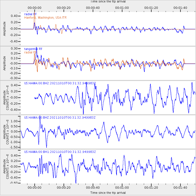
HAWA Hanford, Washington, USA - Earthquake Result Viewer
*The percent match for this event was below the threshold and hence no stack was calculated.
| Earthquake location: |
Central Peru |
| Earthquake latitude/longitude: |
-11.7/-71.7 |
| Earthquake time(UTC): |
2021/10/10 (283) 00:20:41 GMT |
| Earthquake Depth: |
13 km |
| Earthquake Magnitude: |
5.7 mww |
| Earthquake Catalog/Contributor: |
NEIC PDE/us |
|
| Network: |
US United States National Seismic Network |
| Station: |
HAWA Hanford, Washington, USA |
| Lat/Lon: |
46.39 N/119.53 W |
| Elevation: |
364 m |
|
| Distance: |
72.0 deg |
| Az: |
327.359 deg |
| Baz: |
130.252 deg |
| Ray Param: |
$rayparam |
*The percent match for this event was below the threshold and hence was not used in the summary stack. |
|
| Radial Match: |
61.866886 % |
| Radial Bump: |
400 |
| Transverse Match: |
53.581734 % |
| Transverse Bump: |
400 |
| SOD ConfigId: |
26497111 |
| Insert Time: |
2021-10-24 00:42:14.232 +0000 |
| GWidth: |
2.5 |
| Max Bumps: |
400 |
| Tol: |
0.001 |
|
Signal To Noise
| Channel | StoN | STA | LTA |
| US:HAWA:00:BHZ:20211010T00:31:32.949983Z | 2.3954644 | 6.0033136E-7 | 2.5061166E-7 |
| US:HAWA:00:BH1:20211010T00:31:32.949983Z | 1.1551797 | 1.6421335E-7 | 1.4215394E-7 |
| US:HAWA:00:BH2:20211010T00:31:32.949983Z | 2.8227222 | 2.656956E-7 | 9.412744E-8 |
| Arrivals |
| Ps | |
| PpPs | |
| PsPs/PpSs | |


