You are here: Home > Network List > UW - Pacific Northwest Regional Seismic Network Stations List
> Station IRON Crane, OR, USA > Earthquake Result Viewer
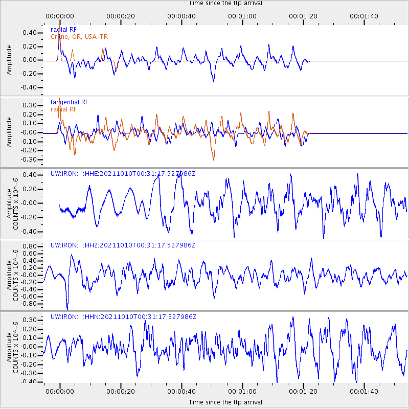
IRON Crane, OR, USA - Earthquake Result Viewer
*The percent match for this event was below the threshold and hence no stack was calculated.
| Earthquake location: |
Central Peru |
| Earthquake latitude/longitude: |
-11.7/-71.7 |
| Earthquake time(UTC): |
2021/10/10 (283) 00:20:41 GMT |
| Earthquake Depth: |
13 km |
| Earthquake Magnitude: |
5.7 mww |
| Earthquake Catalog/Contributor: |
NEIC PDE/us |
|
| Network: |
UW Pacific Northwest Regional Seismic Network |
| Station: |
IRON Crane, OR, USA |
| Lat/Lon: |
43.36 N/118.47 W |
| Elevation: |
1226 m |
|
| Distance: |
69.5 deg |
| Az: |
325.423 deg |
| Baz: |
130.357 deg |
| Ray Param: |
$rayparam |
*The percent match for this event was below the threshold and hence was not used in the summary stack. |
|
| Radial Match: |
60.32591 % |
| Radial Bump: |
381 |
| Transverse Match: |
54.14615 % |
| Transverse Bump: |
382 |
| SOD ConfigId: |
26497111 |
| Insert Time: |
2021-10-24 00:43:35.896 +0000 |
| GWidth: |
2.5 |
| Max Bumps: |
400 |
| Tol: |
0.001 |
|
Signal To Noise
| Channel | StoN | STA | LTA |
| UW:IRON: :HHZ:20211010T00:31:17.527986Z | 2.2537217 | 3.7432125E-7 | 1.6609027E-7 |
| UW:IRON: :HHN:20211010T00:31:17.527986Z | 0.46841595 | 7.0997416E-8 | 1.5156917E-7 |
| UW:IRON: :HHE:20211010T00:31:17.527986Z | 1.8942946 | 2.597543E-7 | 1.3712454E-7 |
| Arrivals |
| Ps | |
| PpPs | |
| PsPs/PpSs | |


