You are here: Home > Network List > UW - Pacific Northwest Regional Seismic Network Stations List
> Station UMAT Pilot Rock, OR, USA > Earthquake Result Viewer
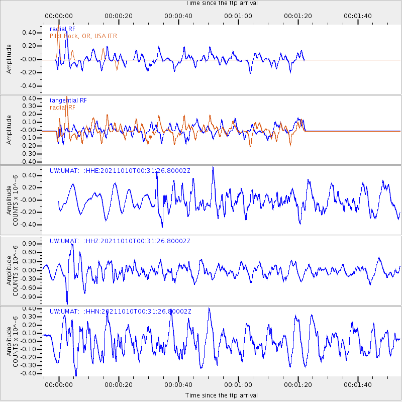
UMAT Pilot Rock, OR, USA - Earthquake Result Viewer
*The percent match for this event was below the threshold and hence no stack was calculated.
| Earthquake location: |
Central Peru |
| Earthquake latitude/longitude: |
-11.7/-71.7 |
| Earthquake time(UTC): |
2021/10/10 (283) 00:20:41 GMT |
| Earthquake Depth: |
13 km |
| Earthquake Magnitude: |
5.7 mww |
| Earthquake Catalog/Contributor: |
NEIC PDE/us |
|
| Network: |
UW Pacific Northwest Regional Seismic Network |
| Station: |
UMAT Pilot Rock, OR, USA |
| Lat/Lon: |
45.29 N/118.96 W |
| Elevation: |
1318 m |
|
| Distance: |
71.0 deg |
| Az: |
326.746 deg |
| Baz: |
130.467 deg |
| Ray Param: |
$rayparam |
*The percent match for this event was below the threshold and hence was not used in the summary stack. |
|
| Radial Match: |
55.44397 % |
| Radial Bump: |
400 |
| Transverse Match: |
50.403736 % |
| Transverse Bump: |
375 |
| SOD ConfigId: |
26497111 |
| Insert Time: |
2021-10-24 00:44:35.204 +0000 |
| GWidth: |
2.5 |
| Max Bumps: |
400 |
| Tol: |
0.001 |
|
Signal To Noise
| Channel | StoN | STA | LTA |
| UW:UMAT: :HHZ:20211010T00:31:26.80002Z | 4.1685233 | 5.0578853E-7 | 1.2133518E-7 |
| UW:UMAT: :HHN:20211010T00:31:26.80002Z | 1.5368165 | 2.0641554E-7 | 1.3431372E-7 |
| UW:UMAT: :HHE:20211010T00:31:26.80002Z | 1.3909636 | 2.0610882E-7 | 1.4817701E-7 |
| Arrivals |
| Ps | |
| PpPs | |
| PsPs/PpSs | |


