You are here: Home > Network List > AV - Alaska Volcano Observatory Stations List
> Station AMKA Regional Station, Amchitka Island, Alaska > Earthquake Result Viewer
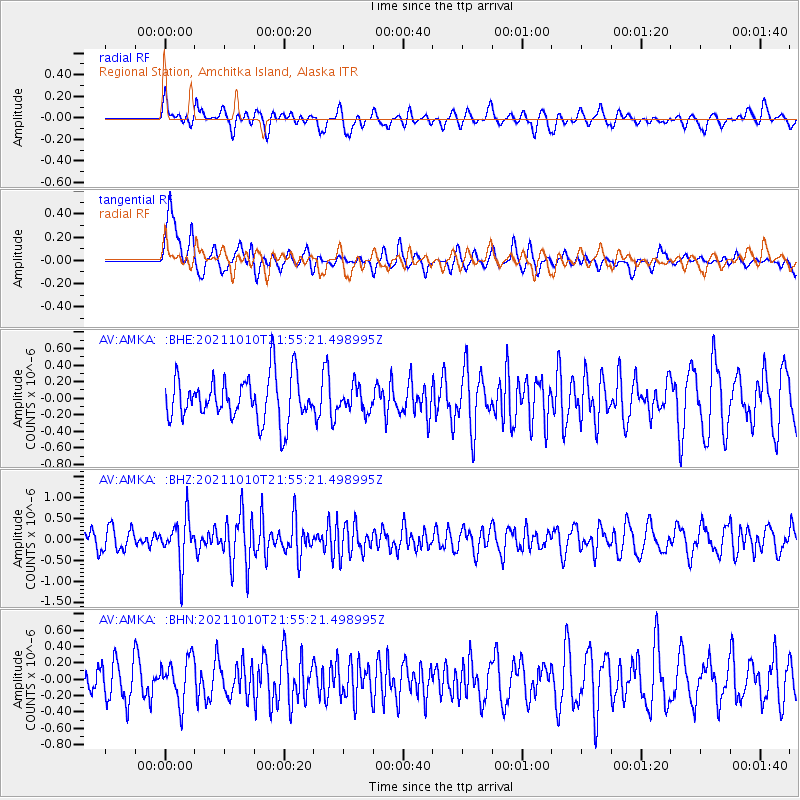
AMKA Regional Station, Amchitka Island, Alaska - Earthquake Result Viewer
*The percent match for this event was below the threshold and hence no stack was calculated.
| Earthquake location: |
Hawaii |
| Earthquake latitude/longitude: |
18.8/-155.5 |
| Earthquake time(UTC): |
2021/10/10 (283) 21:48:36 GMT |
| Earthquake Depth: |
35 km |
| Earthquake Magnitude: |
6.2 Ml |
| Earthquake Catalog/Contributor: |
NEIC PDE/hv |
|
| Network: |
AV Alaska Volcano Observatory |
| Station: |
AMKA Regional Station, Amchitka Island, Alaska |
| Lat/Lon: |
51.38 N/179.30 E |
| Elevation: |
116 m |
|
| Distance: |
38.1 deg |
| Az: |
334.394 deg |
| Baz: |
139.219 deg |
| Ray Param: |
$rayparam |
*The percent match for this event was below the threshold and hence was not used in the summary stack. |
|
| Radial Match: |
56.432533 % |
| Radial Bump: |
400 |
| Transverse Match: |
65.5378 % |
| Transverse Bump: |
400 |
| SOD ConfigId: |
26497111 |
| Insert Time: |
2021-10-24 21:55:04.508 +0000 |
| GWidth: |
2.5 |
| Max Bumps: |
400 |
| Tol: |
0.001 |
|
Signal To Noise
| Channel | StoN | STA | LTA |
| AV:AMKA: :BHZ:20211010T21:55:21.498995Z | 2.3969765 | 5.56787E-7 | 2.322872E-7 |
| AV:AMKA: :BHN:20211010T21:55:21.498995Z | 1.3290015 | 2.6945872E-7 | 2.0275276E-7 |
| AV:AMKA: :BHE:20211010T21:55:21.498995Z | 0.5426446 | 1.4393598E-7 | 2.6524907E-7 |
| Arrivals |
| Ps | |
| PpPs | |
| PsPs/PpSs | |


