You are here: Home > Network List > CI - Caltech Regional Seismic Network Stations List
> Station MPP McPhearson Peak > Earthquake Result Viewer
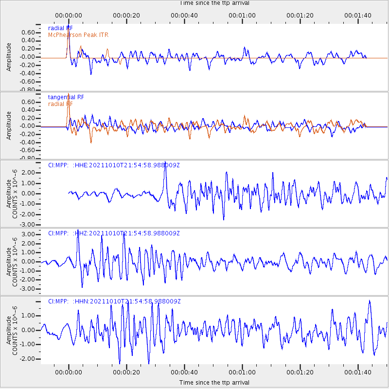
MPP McPhearson Peak - Earthquake Result Viewer
*The percent match for this event was below the threshold and hence no stack was calculated.
| Earthquake location: |
Hawaii |
| Earthquake latitude/longitude: |
18.8/-155.5 |
| Earthquake time(UTC): |
2021/10/10 (283) 21:48:36 GMT |
| Earthquake Depth: |
35 km |
| Earthquake Magnitude: |
6.2 Ml |
| Earthquake Catalog/Contributor: |
NEIC PDE/hv |
|
| Network: |
CI Caltech Regional Seismic Network |
| Station: |
MPP McPhearson Peak |
| Lat/Lon: |
34.89 N/119.81 W |
| Elevation: |
1739 m |
|
| Distance: |
35.4 deg |
| Az: |
55.867 deg |
| Baz: |
252.503 deg |
| Ray Param: |
$rayparam |
*The percent match for this event was below the threshold and hence was not used in the summary stack. |
|
| Radial Match: |
67.94462 % |
| Radial Bump: |
400 |
| Transverse Match: |
49.385563 % |
| Transverse Bump: |
400 |
| SOD ConfigId: |
26497111 |
| Insert Time: |
2021-10-24 22:00:51.683 +0000 |
| GWidth: |
2.5 |
| Max Bumps: |
400 |
| Tol: |
0.001 |
|
Signal To Noise
| Channel | StoN | STA | LTA |
| CI:MPP: :HHZ:20211010T21:54:58.988009Z | 7.590274 | 1.3305481E-6 | 1.7529646E-7 |
| CI:MPP: :HHN:20211010T21:54:58.988009Z | 1.6858339 | 6.19678E-7 | 3.675795E-7 |
| CI:MPP: :HHE:20211010T21:54:58.988009Z | 4.43045 | 1.1083507E-6 | 2.5016664E-7 |
| Arrivals |
| Ps | |
| PpPs | |
| PsPs/PpSs | |


