You are here: Home > Network List > CI - Caltech Regional Seismic Network Stations List
> Station SMM Simmler, CA, USA > Earthquake Result Viewer
SMM Simmler, CA, USA - Earthquake Result Viewer
*The percent match for this event was below the threshold and hence no stack was calculated.
| Earthquake location: |
Hawaii |
| Earthquake latitude/longitude: |
18.8/-155.5 |
| Earthquake time(UTC): |
2021/10/10 (283) 21:48:36 GMT |
| Earthquake Depth: |
35 km |
| Earthquake Magnitude: |
6.2 Ml |
| Earthquake Catalog/Contributor: |
NEIC PDE/hv |
|
| Network: |
CI Caltech Regional Seismic Network |
| Station: |
SMM Simmler, CA, USA |
| Lat/Lon: |
35.31 N/120.00 W |
| Elevation: |
599 m |
|
| Distance: |
35.4 deg |
| Az: |
55.091 deg |
| Baz: |
251.766 deg |
| Ray Param: |
$rayparam |
*The percent match for this event was below the threshold and hence was not used in the summary stack. |
|
| Radial Match: |
74.28583 % |
| Radial Bump: |
400 |
| Transverse Match: |
65.55345 % |
| Transverse Bump: |
400 |
| SOD ConfigId: |
26497111 |
| Insert Time: |
2021-10-24 22:01:22.786 +0000 |
| GWidth: |
2.5 |
| Max Bumps: |
400 |
| Tol: |
0.001 |
|
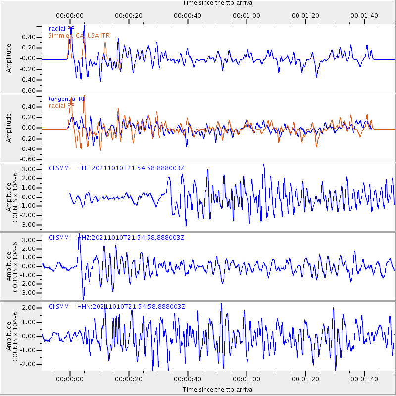
Signal To Noise
| Channel | StoN | STA | LTA |
| CI:SMM: :HHZ:20211010T21:54:58.888003Z | 6.444555 | 1.6717255E-6 | 2.5940122E-7 |
| CI:SMM: :HHN:20211010T21:54:58.888003Z | 0.9848319 | 3.4736854E-7 | 3.527186E-7 |
| CI:SMM: :HHE:20211010T21:54:58.888003Z | 3.2273405 | 1.0923537E-6 | 3.384687E-7 |
| Arrivals |
| Ps | |
| PpPs | |
| PsPs/PpSs | |


