You are here: Home > Network List > US - United States National Seismic Network Stations List
> Station AMTX Amarillo, Texas, USA > Earthquake Result Viewer
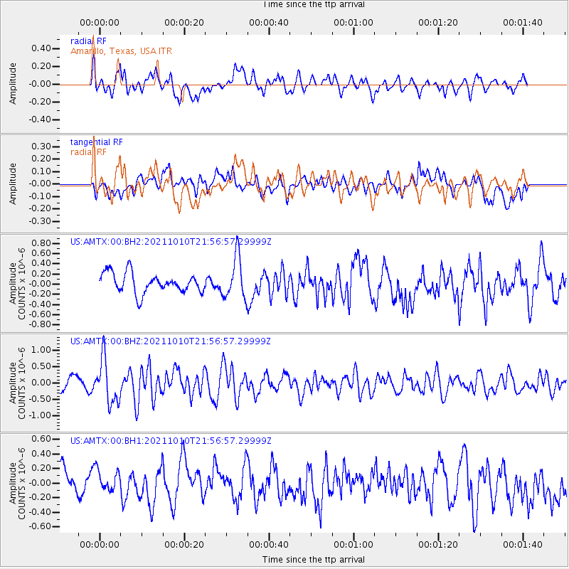
AMTX Amarillo, Texas, USA - Earthquake Result Viewer
*The percent match for this event was below the threshold and hence no stack was calculated.
| Earthquake location: |
Hawaii |
| Earthquake latitude/longitude: |
18.8/-155.5 |
| Earthquake time(UTC): |
2021/10/10 (283) 21:48:36 GMT |
| Earthquake Depth: |
35 km |
| Earthquake Magnitude: |
6.2 Ml |
| Earthquake Catalog/Contributor: |
NEIC PDE/hv |
|
| Network: |
US United States National Seismic Network |
| Station: |
AMTX Amarillo, Texas, USA |
| Lat/Lon: |
34.53 N/101.41 W |
| Elevation: |
1010 m |
|
| Distance: |
50.3 deg |
| Az: |
60.446 deg |
| Baz: |
266.383 deg |
| Ray Param: |
$rayparam |
*The percent match for this event was below the threshold and hence was not used in the summary stack. |
|
| Radial Match: |
67.50104 % |
| Radial Bump: |
400 |
| Transverse Match: |
42.88773 % |
| Transverse Bump: |
400 |
| SOD ConfigId: |
26497111 |
| Insert Time: |
2021-10-24 22:19:49.116 +0000 |
| GWidth: |
2.5 |
| Max Bumps: |
400 |
| Tol: |
0.001 |
|
Signal To Noise
| Channel | StoN | STA | LTA |
| US:AMTX:00:BHZ:20211010T21:56:57.29999Z | 3.2858768 | 6.8700473E-7 | 2.0907807E-7 |
| US:AMTX:00:BH1:20211010T21:56:57.29999Z | 0.6758816 | 1.4381074E-7 | 2.1277503E-7 |
| US:AMTX:00:BH2:20211010T21:56:57.29999Z | 2.4317186 | 4.6174986E-7 | 1.8988622E-7 |
| Arrivals |
| Ps | |
| PpPs | |
| PsPs/PpSs | |


