You are here: Home > Network List > US - United States National Seismic Network Stations List
> Station DGMT Dagmar, Montana, USA > Earthquake Result Viewer
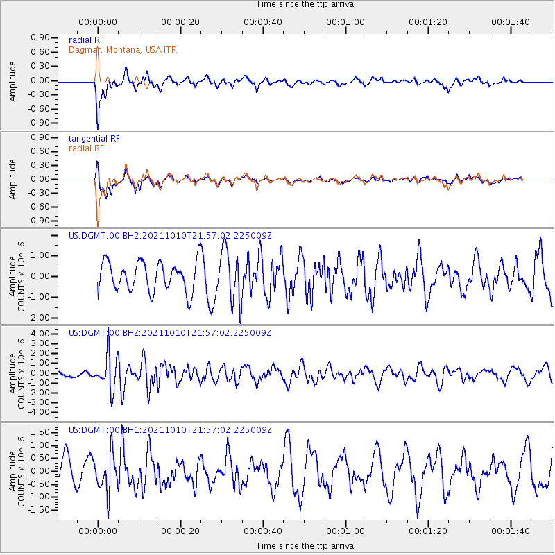
DGMT Dagmar, Montana, USA - Earthquake Result Viewer
*The percent match for this event was below the threshold and hence no stack was calculated.
| Earthquake location: |
Hawaii |
| Earthquake latitude/longitude: |
18.8/-155.5 |
| Earthquake time(UTC): |
2021/10/10 (283) 21:48:36 GMT |
| Earthquake Depth: |
35 km |
| Earthquake Magnitude: |
6.2 Ml |
| Earthquake Catalog/Contributor: |
NEIC PDE/hv |
|
| Network: |
US United States National Seismic Network |
| Station: |
DGMT Dagmar, Montana, USA |
| Lat/Lon: |
48.47 N/104.20 W |
| Elevation: |
0.0 m |
|
| Distance: |
50.7 deg |
| Az: |
42.171 deg |
| Baz: |
252.843 deg |
| Ray Param: |
$rayparam |
*The percent match for this event was below the threshold and hence was not used in the summary stack. |
|
| Radial Match: |
77.66309 % |
| Radial Bump: |
400 |
| Transverse Match: |
75.298615 % |
| Transverse Bump: |
400 |
| SOD ConfigId: |
26497111 |
| Insert Time: |
2021-10-24 22:20:00.515 +0000 |
| GWidth: |
2.5 |
| Max Bumps: |
400 |
| Tol: |
0.001 |
|
Signal To Noise
| Channel | StoN | STA | LTA |
| US:DGMT:00:BHZ:20211010T21:57:02.225009Z | 4.3183155 | 1.806861E-6 | 4.18418E-7 |
| US:DGMT:00:BH1:20211010T21:57:02.225009Z | 1.2856259 | 7.2555616E-7 | 5.643603E-7 |
| US:DGMT:00:BH2:20211010T21:57:02.225009Z | 1.789692 | 1.2597638E-6 | 7.0389984E-7 |
| Arrivals |
| Ps | |
| PpPs | |
| PsPs/PpSs | |


