You are here: Home > Network List > US - United States National Seismic Network Stations List
> Station EGMT Eagleton, Montana, USA > Earthquake Result Viewer
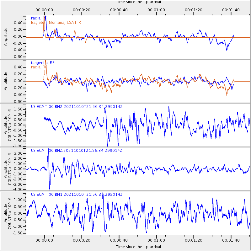
EGMT Eagleton, Montana, USA - Earthquake Result Viewer
*The percent match for this event was below the threshold and hence no stack was calculated.
| Earthquake location: |
Hawaii |
| Earthquake latitude/longitude: |
18.8/-155.5 |
| Earthquake time(UTC): |
2021/10/10 (283) 21:48:36 GMT |
| Earthquake Depth: |
35 km |
| Earthquake Magnitude: |
6.2 Ml |
| Earthquake Catalog/Contributor: |
NEIC PDE/hv |
|
| Network: |
US United States National Seismic Network |
| Station: |
EGMT Eagleton, Montana, USA |
| Lat/Lon: |
48.02 N/109.75 W |
| Elevation: |
1055 m |
|
| Distance: |
47.1 deg |
| Az: |
41.075 deg |
| Baz: |
247.986 deg |
| Ray Param: |
$rayparam |
*The percent match for this event was below the threshold and hence was not used in the summary stack. |
|
| Radial Match: |
54.311615 % |
| Radial Bump: |
400 |
| Transverse Match: |
49.45758 % |
| Transverse Bump: |
400 |
| SOD ConfigId: |
26497111 |
| Insert Time: |
2021-10-24 22:20:05.212 +0000 |
| GWidth: |
2.5 |
| Max Bumps: |
400 |
| Tol: |
0.001 |
|
Signal To Noise
| Channel | StoN | STA | LTA |
| US:EGMT:00:BHZ:20211010T21:56:34.299014Z | 7.8384476 | 1.7014983E-6 | 2.1707082E-7 |
| US:EGMT:00:BH1:20211010T21:56:34.299014Z | 1.1230321 | 5.0641603E-7 | 4.5093637E-7 |
| US:EGMT:00:BH2:20211010T21:56:34.299014Z | 2.3943284 | 9.4223E-7 | 3.935258E-7 |
| Arrivals |
| Ps | |
| PpPs | |
| PsPs/PpSs | |


