You are here: Home > Network List > US - United States National Seismic Network Stations List
> Station ERPA Erie, Pennsylvania, USA > Earthquake Result Viewer
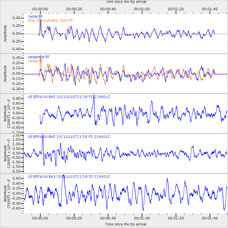
ERPA Erie, Pennsylvania, USA - Earthquake Result Viewer
*The percent match for this event was below the threshold and hence no stack was calculated.
| Earthquake location: |
Hawaii |
| Earthquake latitude/longitude: |
18.8/-155.5 |
| Earthquake time(UTC): |
2021/10/10 (283) 21:48:36 GMT |
| Earthquake Depth: |
35 km |
| Earthquake Magnitude: |
6.2 Ml |
| Earthquake Catalog/Contributor: |
NEIC PDE/hv |
|
| Network: |
US United States National Seismic Network |
| Station: |
ERPA Erie, Pennsylvania, USA |
| Lat/Lon: |
42.12 N/79.99 W |
| Elevation: |
306 m |
|
| Distance: |
67.0 deg |
| Az: |
51.488 deg |
| Baz: |
275.017 deg |
| Ray Param: |
$rayparam |
*The percent match for this event was below the threshold and hence was not used in the summary stack. |
|
| Radial Match: |
53.95291 % |
| Radial Bump: |
400 |
| Transverse Match: |
57.773506 % |
| Transverse Bump: |
400 |
| SOD ConfigId: |
26497111 |
| Insert Time: |
2021-10-24 22:20:07.897 +0000 |
| GWidth: |
2.5 |
| Max Bumps: |
400 |
| Tol: |
0.001 |
|
Signal To Noise
| Channel | StoN | STA | LTA |
| US:ERPA:00:BHZ:20211010T21:58:55.224001Z | 2.7143083 | 7.5285755E-7 | 2.7736627E-7 |
| US:ERPA:00:BH1:20211010T21:58:55.224001Z | 0.8658804 | 2.4176043E-7 | 2.7920765E-7 |
| US:ERPA:00:BH2:20211010T21:58:55.224001Z | 2.2839613 | 4.8352837E-7 | 2.1170604E-7 |
| Arrivals |
| Ps | |
| PpPs | |
| PsPs/PpSs | |


