You are here: Home > Network List > UW - Pacific Northwest Regional Seismic Network Stations List
> Station UMAT Pilot Rock, OR, USA > Earthquake Result Viewer
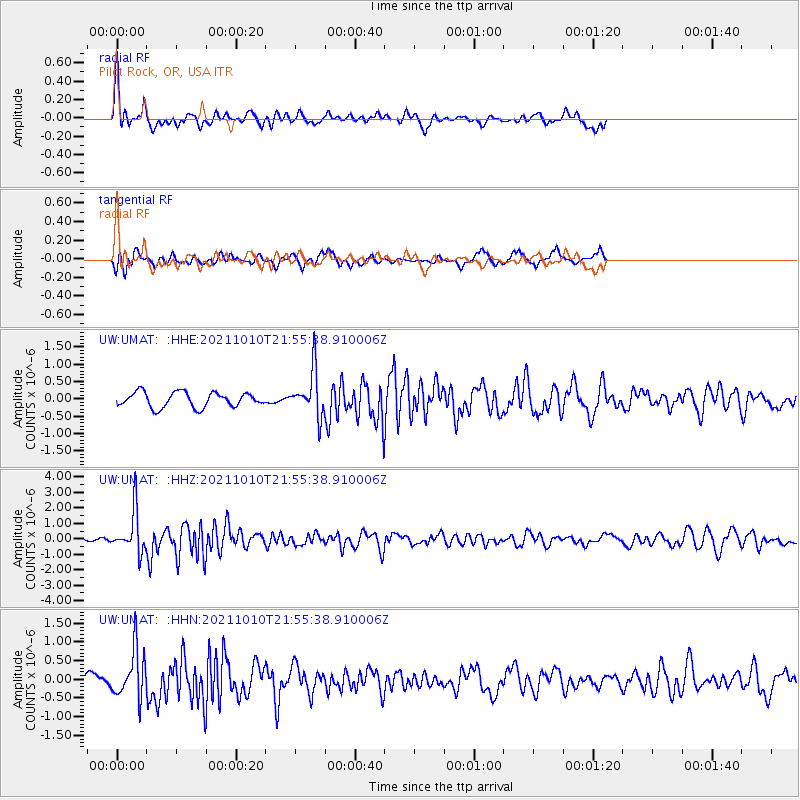
UMAT Pilot Rock, OR, USA - Earthquake Result Viewer
*The percent match for this event was below the threshold and hence no stack was calculated.
| Earthquake location: |
Hawaii |
| Earthquake latitude/longitude: |
18.8/-155.5 |
| Earthquake time(UTC): |
2021/10/10 (283) 21:48:36 GMT |
| Earthquake Depth: |
35 km |
| Earthquake Magnitude: |
6.2 Ml |
| Earthquake Catalog/Contributor: |
NEIC PDE/hv |
|
| Network: |
UW Pacific Northwest Regional Seismic Network |
| Station: |
UMAT Pilot Rock, OR, USA |
| Lat/Lon: |
45.29 N/118.96 W |
| Elevation: |
1318 m |
|
| Distance: |
40.2 deg |
| Az: |
40.69 deg |
| Baz: |
241.024 deg |
| Ray Param: |
$rayparam |
*The percent match for this event was below the threshold and hence was not used in the summary stack. |
|
| Radial Match: |
66.58718 % |
| Radial Bump: |
339 |
| Transverse Match: |
67.326584 % |
| Transverse Bump: |
392 |
| SOD ConfigId: |
26497111 |
| Insert Time: |
2021-10-24 22:23:06.297 +0000 |
| GWidth: |
2.5 |
| Max Bumps: |
400 |
| Tol: |
0.001 |
|
Signal To Noise
| Channel | StoN | STA | LTA |
| UW:UMAT: :HHZ:20211010T21:55:38.910006Z | 11.8939495 | 1.3394334E-6 | 1.1261469E-7 |
| UW:UMAT: :HHN:20211010T21:55:38.910006Z | 3.913927 | 6.433958E-7 | 1.6438626E-7 |
| UW:UMAT: :HHE:20211010T21:55:38.910006Z | 3.1050484 | 6.6829125E-7 | 2.1522733E-7 |
| Arrivals |
| Ps | |
| PpPs | |
| PsPs/PpSs | |


