You are here: Home > Network List > CI - Caltech Regional Seismic Network Stations List
> Station ARV Arvin, Arvin, CA, USA > Earthquake Result Viewer
ARV Arvin, Arvin, CA, USA - Earthquake Result Viewer

| Earthquake location: |
Alaska Peninsula |
| Earthquake latitude/longitude: |
56.3/-156.6 |
| Earthquake time(UTC): |
2021/10/11 (284) 09:10:24 GMT |
| Earthquake Depth: |
69 km |
| Earthquake Magnitude: |
6.9 mww |
| Earthquake Catalog/Contributor: |
NEIC PDE/ak |
|
| Network: |
CI Caltech Regional Seismic Network |
| Station: |
ARV Arvin, Arvin, CA, USA |
| Lat/Lon: |
35.13 N/118.83 W |
| Elevation: |
258 m |
|
| Distance: |
33.2 deg |
| Az: |
113.53 deg |
| Baz: |
321.378 deg |
| Ray Param: |
0.07817656 |
| Estimated Moho Depth: |
37.5 km |
| Estimated Crust Vp/Vs: |
2.10 |
| Assumed Crust Vp: |
6.1 km/s |
| Estimated Crust Vs: |
2.908 km/s |
| Estimated Crust Poisson's Ratio: |
0.35 |
|
| Radial Match: |
84.19349 % |
| Radial Bump: |
400 |
| Transverse Match: |
58.559334 % |
| Transverse Bump: |
400 |
| SOD ConfigId: |
26497111 |
| Insert Time: |
2021-10-25 09:13:42.999 +0000 |
| GWidth: |
2.5 |
| Max Bumps: |
400 |
| Tol: |
0.001 |
|
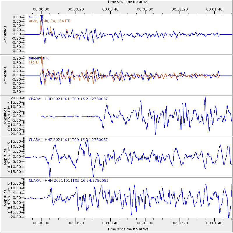
Signal To Noise
| Channel | StoN | STA | LTA |
| CI:ARV: :HHZ:20211011T09:16:24.278008Z | 20.178137 | 4.3545165E-6 | 2.1580368E-7 |
| CI:ARV: :HHN:20211011T09:16:24.278008Z | 3.2897437 | 1.1428692E-6 | 3.4740373E-7 |
| CI:ARV: :HHE:20211011T09:16:24.278008Z | 4.234502 | 1.5261177E-6 | 3.6040078E-7 |
| Arrivals |
| Ps | 7.2 SECOND |
| PpPs | 18 SECOND |
| PsPs/PpSs | 25 SECOND |


