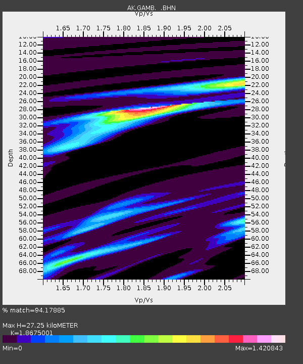
GAMB Gambell Broadband - Earthquake Result Viewer
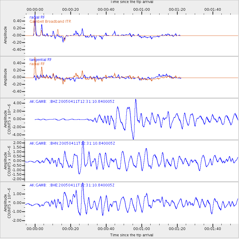
Earthquake location: Near N Coast Of New Guinea, P.N.G.
Earthquake latitude/longitude: -3.5/145.9
Earthquake time(UTC): 2005/04/11 (101) 12:20:05 GMT
Earthquake Depth: 11 km
Earthquake Magnitude: 5.9 MB, 6.7 MS, 6.7 MW, 6.5 MW
Earthquake Catalog/Contributor: WHDF/NEIC
Network: AK Alaska Regional Network
Station: GAMB Gambell Broadband
Lat/Lon: 63.78 N/171.70 W
Elevation: 10 m
Distance: 74.1 deg
Az: 18.142 deg
Baz: 224.396 deg
Ray Param: 0.052537255
Estimated Moho Depth: 27.25 km
Estimated Crust Vp/Vs: 1.87
Assumed Crust Vp: 6.24 km/s
Estimated Crust Vs: 3.341 km/s
Estimated Crust Poisson's Ratio: 0.30
Radial Match: 94.17885 %
Radial Bump: 371
Transverse Match: 62.052067 %
Transverse Bump: 400
SOD ConfigId: 2459
Insert Time: 2010-03-09 13:40:48.813 +0000
GWidth: 2.5
Max Bumps: 400
Tol: 0.001

Signal To Noise

ChannelStoNSTALTA
AK:GAMB: :BHN:20050411T12:31:10.840005Z0.767317061.0520409E-71.3710641E-7
AK:GAMB: :BHE:20050411T12:31:10.840005Z0.89203891.6399989E-71.8384836E-7
AK:GAMB: :BHZ:20050411T12:31:10.840005Z3.17229842.6998043E-78.510562E-8
Arrivals
Ps3.9 SECOND
PpPs12 SECOND
PsPs/PpSs16 SECOND