You are here: Home > Network List > AK - Alaska Regional Network Stations List
> Station GAMB Gambell Broadband > Earthquake Result Viewer
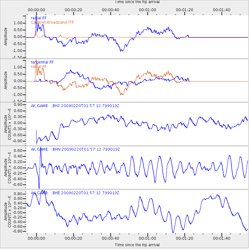
GAMB Gambell Broadband - Earthquake Result Viewer
*The percent match for this event was below the threshold and hence no stack was calculated.
| Earthquake location: |
Fiji Islands Region |
| Earthquake latitude/longitude: |
-18.4/-178.7 |
| Earthquake time(UTC): |
2009/02/20 (051) 01:46:17 GMT |
| Earthquake Depth: |
515 km |
| Earthquake Magnitude: |
5.6 MW, 5.1 MB, 5.6 MW |
| Earthquake Catalog/Contributor: |
WHDF/NEIC |
|
| Network: |
AK Alaska Regional Network |
| Station: |
GAMB Gambell Broadband |
| Lat/Lon: |
63.78 N/171.70 W |
| Elevation: |
10 m |
|
| Distance: |
82.1 deg |
| Az: |
3.155 deg |
| Baz: |
186.757 deg |
| Ray Param: |
$rayparam |
*The percent match for this event was below the threshold and hence was not used in the summary stack. |
|
| Radial Match: |
31.432749 % |
| Radial Bump: |
400 |
| Transverse Match: |
46.30549 % |
| Transverse Bump: |
400 |
| SOD ConfigId: |
2658 |
| Insert Time: |
2010-03-09 13:40:59.839 +0000 |
| GWidth: |
2.5 |
| Max Bumps: |
400 |
| Tol: |
0.001 |
|
Signal To Noise
| Channel | StoN | STA | LTA |
| AK:GAMB: :BHN:20090220T01:57:12.799019Z | 1.9588153 | 3.000576E-7 | 1.5318321E-7 |
| AK:GAMB: :BHE:20090220T01:57:12.799019Z | 4.268332 | 1.0268202E-6 | 2.405671E-7 |
| AK:GAMB: :BHZ:20090220T01:57:12.799019Z | 1.4495564 | 5.5765776E-7 | 3.8470924E-7 |
| Arrivals |
| Ps | |
| PpPs | |
| PsPs/PpSs | |


