You are here: Home > Network List > II - Global Seismograph Network (GSN - IRIS/IDA) Stations List
> Station JTS Las Juntas de Abangares, Costa Rica > Earthquake Result Viewer
JTS Las Juntas de Abangares, Costa Rica - Earthquake Result Viewer

| Earthquake location: |
Alaska Peninsula |
| Earthquake latitude/longitude: |
56.3/-156.6 |
| Earthquake time(UTC): |
2021/10/11 (284) 09:10:24 GMT |
| Earthquake Depth: |
69 km |
| Earthquake Magnitude: |
6.9 mww |
| Earthquake Catalog/Contributor: |
NEIC PDE/ak |
|
| Network: |
II Global Seismograph Network (GSN - IRIS/IDA) |
| Station: |
JTS Las Juntas de Abangares, Costa Rica |
| Lat/Lon: |
10.29 N/84.95 W |
| Elevation: |
340 m |
|
| Distance: |
71.3 deg |
| Az: |
99.646 deg |
| Baz: |
326.012 deg |
| Ray Param: |
0.054275583 |
| Estimated Moho Depth: |
46.0 km |
| Estimated Crust Vp/Vs: |
1.96 |
| Assumed Crust Vp: |
6.597 km/s |
| Estimated Crust Vs: |
3.362 km/s |
| Estimated Crust Poisson's Ratio: |
0.32 |
|
| Radial Match: |
84.72725 % |
| Radial Bump: |
400 |
| Transverse Match: |
65.268814 % |
| Transverse Bump: |
400 |
| SOD ConfigId: |
26497111 |
| Insert Time: |
2021-10-25 09:21:34.216 +0000 |
| GWidth: |
2.5 |
| Max Bumps: |
400 |
| Tol: |
0.001 |
|
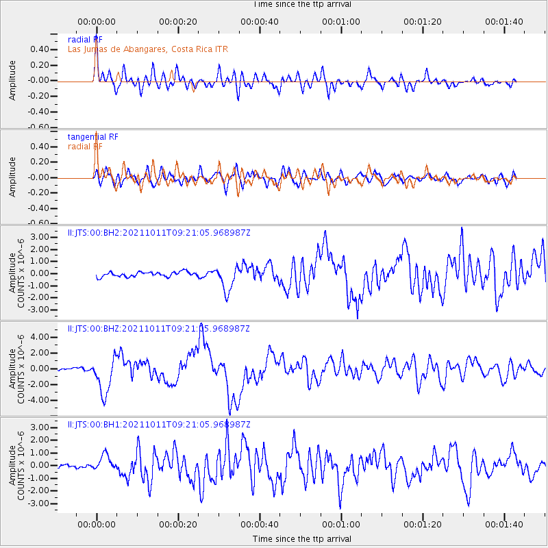
Signal To Noise
| Channel | StoN | STA | LTA |
| II:JTS:00:BHZ:20211011T09:21:05.968987Z | 16.509995 | 2.4236053E-6 | 1.4679625E-7 |
| II:JTS:00:BH1:20211011T09:21:05.968987Z | 4.835271 | 6.548261E-7 | 1.3542697E-7 |
| II:JTS:00:BH2:20211011T09:21:05.968987Z | 5.446348 | 1.063424E-6 | 1.9525449E-7 |
| Arrivals |
| Ps | 6.9 SECOND |
| PpPs | 20 SECOND |
| PsPs/PpSs | 27 SECOND |


