You are here: Home > Network List > US - United States National Seismic Network Stations List
> Station DGMT Dagmar, Montana, USA > Earthquake Result Viewer
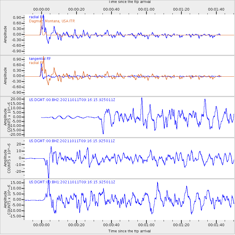
DGMT Dagmar, Montana, USA - Earthquake Result Viewer
*The percent match for this event was below the threshold and hence no stack was calculated.
| Earthquake location: |
Alaska Peninsula |
| Earthquake latitude/longitude: |
56.3/-156.6 |
| Earthquake time(UTC): |
2021/10/11 (284) 09:10:24 GMT |
| Earthquake Depth: |
69 km |
| Earthquake Magnitude: |
6.9 mww |
| Earthquake Catalog/Contributor: |
NEIC PDE/ak |
|
| Network: |
US United States National Seismic Network |
| Station: |
DGMT Dagmar, Montana, USA |
| Lat/Lon: |
48.47 N/104.20 W |
| Elevation: |
0.0 m |
|
| Distance: |
32.2 deg |
| Az: |
81.449 deg |
| Baz: |
303.985 deg |
| Ray Param: |
$rayparam |
*The percent match for this event was below the threshold and hence was not used in the summary stack. |
|
| Radial Match: |
93.816986 % |
| Radial Bump: |
321 |
| Transverse Match: |
96.63482 % |
| Transverse Bump: |
208 |
| SOD ConfigId: |
26497111 |
| Insert Time: |
2021-10-25 09:36:28.608 +0000 |
| GWidth: |
2.5 |
| Max Bumps: |
400 |
| Tol: |
0.001 |
|
Signal To Noise
| Channel | StoN | STA | LTA |
| US:DGMT:00:BHZ:20211011T09:16:15.925011Z | 27.405539 | 9.72528E-6 | 3.548655E-7 |
| US:DGMT:00:BH1:20211011T09:16:15.925011Z | 13.415956 | 6.376794E-6 | 4.7531418E-7 |
| US:DGMT:00:BH2:20211011T09:16:15.925011Z | 2.9870064 | 2.6273149E-6 | 8.7958125E-7 |
| Arrivals |
| Ps | |
| PpPs | |
| PsPs/PpSs | |


