RUMJ YL.RUMJ - Earthquake Result Viewer
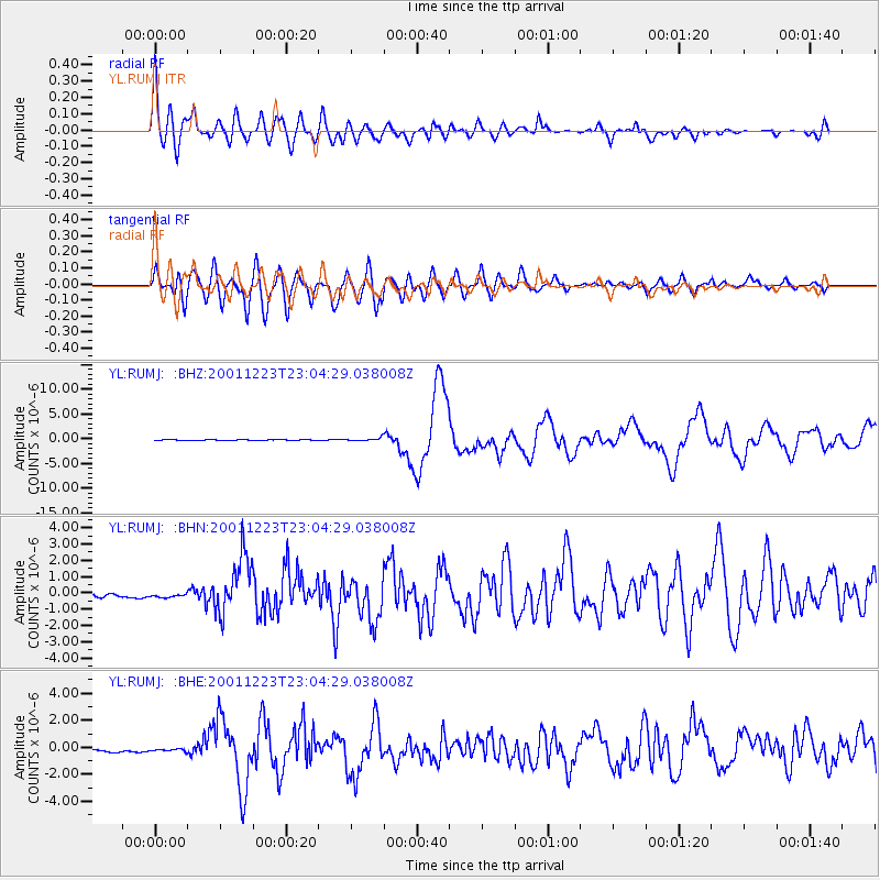
Earthquake location: Solomon Islands
Earthquake latitude/longitude: -9.6/159.5
Earthquake time(UTC): 2001/12/23 (357) 22:52:54 GMT
Earthquake Depth: 16 km
Earthquake Magnitude: 6.2 MB, 7.0 MS, 6.8 MW, 6.7 MW
Earthquake Catalog/Contributor: WHDF/NEIC
Network: YL Himalayan Nepal Tibet Experiment
Station: RUMJ YL.RUMJ
Lat/Lon: 27.30 N/86.55 E
Elevation: 1319 m
Distance: 79.6 deg
Az: 300.096 deg
Baz: 106.5 deg
Ray Param: 0.048862997
Estimated Moho Depth: 38.0 km
Estimated Crust Vp/Vs: 1.74
Assumed Crust Vp: 6.236 km/s
Estimated Crust Vs: 3.584 km/s
Estimated Crust Poisson's Ratio: 0.25
Radial Match: 88.46253 %
Radial Bump: 400
Transverse Match: 80.10908 %
Transverse Bump: 400
SOD ConfigId: 16820
Insert Time: 2010-02-26 16:06:22.164 +0000
GWidth: 2.5
Max Bumps: 400
Tol: 0.001

Signal To Noise

ChannelStoNSTALTA
YL:RUMJ: :BHN:20011223T23:04:29.038008Z1.10021761.7369906E-71.5787701E-7
YL:RUMJ: :BHE:20011223T23:04:29.038008Z0.63126979.0076014E-81.4269023E-7
YL:RUMJ: :BHZ:20011223T23:04:29.038008Z3.32996063.174414E-79.532887E-8
Arrivals
Ps4.6 SECOND
PpPs16 SECOND
PsPs/PpSs21 SECOND