RUMJ YL.RUMJ - Earthquake Result Viewer
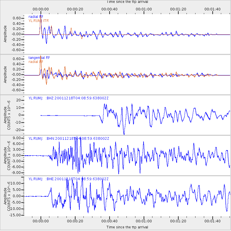
Earthquake location: Taiwan Region
Earthquake latitude/longitude: 24.0/122.7
Earthquake time(UTC): 2001/12/18 (352) 04:02:58 GMT
Earthquake Depth: 14 km
Earthquake Magnitude: 6.3 MB, 7.3 MS, 6.9 MW, 6.8 MW
Earthquake Catalog/Contributor: WHDF/NEIC
Network: YL Himalayan Nepal Tibet Experiment
Station: RUMJ YL.RUMJ
Lat/Lon: 27.30 N/86.55 E
Elevation: 1319 m
Distance: 32.7 deg
Az: 283.64 deg
Baz: 87.632 deg
Ray Param: 0.07852173
Estimated Moho Depth: 15.0 km
Estimated Crust Vp/Vs: 1.76
Assumed Crust Vp: 6.236 km/s
Estimated Crust Vs: 3.548 km/s
Estimated Crust Poisson's Ratio: 0.26
Radial Match: 89.9437 %
Radial Bump: 400
Transverse Match: 79.841934 %
Transverse Bump: 400
SOD ConfigId: 16820
Insert Time: 2010-02-26 16:06:24.463 +0000
GWidth: 2.5
Max Bumps: 400
Tol: 0.001

Signal To Noise

ChannelStoNSTALTA
YL:RUMJ: :BHN:20011218T04:08:59.638002Z0.89082091.1189818E-71.2561243E-7
YL:RUMJ: :BHE:20011218T04:08:59.638002Z3.25270274.3951766E-71.3512383E-7
YL:RUMJ: :BHZ:20011218T04:08:59.638002Z9.3422487.9573624E-78.51761E-8
Arrivals
Ps2.0 SECOND
PpPs6.2 SECOND
PsPs/PpSs8.1 SECOND