You are here: Home > Network List > AV - Alaska Volcano Observatory Stations List
> Station SPCR Ckakachatna River, Mount Spurr, Alaska > Earthquake Result Viewer
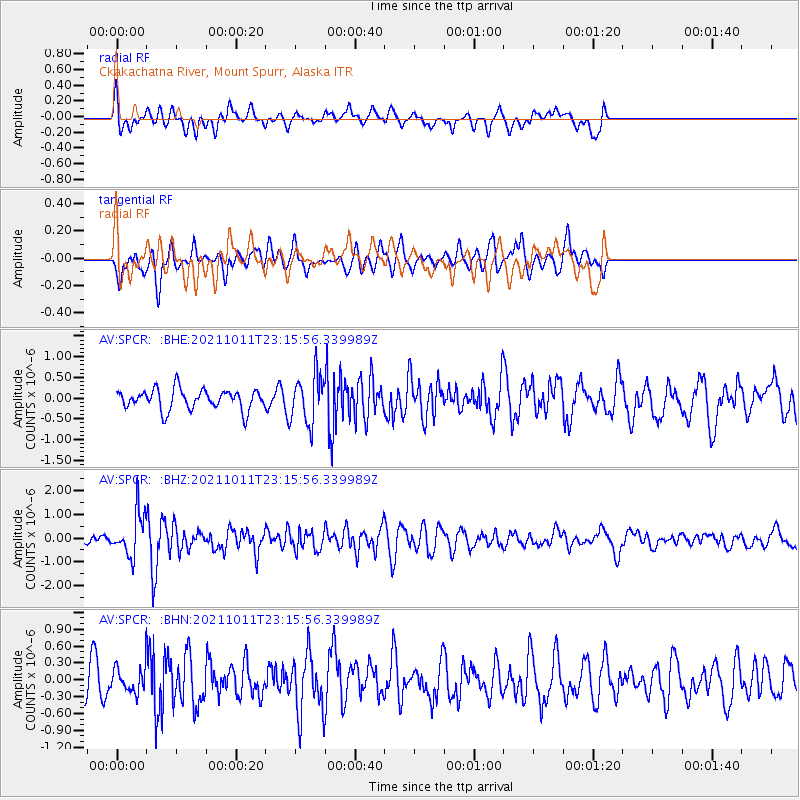
SPCR Ckakachatna River, Mount Spurr, Alaska - Earthquake Result Viewer
*The percent match for this event was below the threshold and hence no stack was calculated.
| Earthquake location: |
Kuril Islands |
| Earthquake latitude/longitude: |
48.3/153.7 |
| Earthquake time(UTC): |
2021/10/11 (284) 23:10:00 GMT |
| Earthquake Depth: |
70 km |
| Earthquake Magnitude: |
5.8 Mww |
| Earthquake Catalog/Contributor: |
NEIC PDE/us |
|
| Network: |
AV Alaska Volcano Observatory |
| Station: |
SPCR Ckakachatna River, Mount Spurr, Alaska |
| Lat/Lon: |
61.20 N/152.21 W |
| Elevation: |
984 m |
|
| Distance: |
32.7 deg |
| Az: |
46.453 deg |
| Baz: |
271.846 deg |
| Ray Param: |
$rayparam |
*The percent match for this event was below the threshold and hence was not used in the summary stack. |
|
| Radial Match: |
62.443584 % |
| Radial Bump: |
400 |
| Transverse Match: |
64.624565 % |
| Transverse Bump: |
400 |
| SOD ConfigId: |
26497111 |
| Insert Time: |
2021-10-25 23:15:24.942 +0000 |
| GWidth: |
2.5 |
| Max Bumps: |
400 |
| Tol: |
0.001 |
|
Signal To Noise
| Channel | StoN | STA | LTA |
| AV:SPCR: :BHZ:20211011T23:15:56.339989Z | 3.3765783 | 9.15508E-7 | 2.7113484E-7 |
| AV:SPCR: :BHN:20211011T23:15:56.339989Z | 0.6785322 | 2.0473229E-7 | 3.017282E-7 |
| AV:SPCR: :BHE:20211011T23:15:56.339989Z | 2.3478262 | 5.785979E-7 | 2.4643984E-7 |
| Arrivals |
| Ps | |
| PpPs | |
| PsPs/PpSs | |


