
RUMJ YL.RUMJ - Earthquake Result Viewer
| ||||||||||||||||||
| ||||||||||||||||||
| ||||||||||||||||||
|
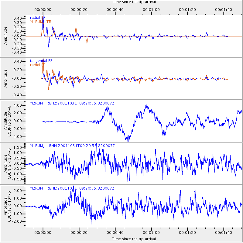
Signal To Noise
| Channel | StoN | STA | LTA |
| YL:RUMJ: :BHN:20011031T09:20:55.820007Z | 3.2458017 | 2.343707E-7 | 7.2207335E-8 |
| YL:RUMJ: :BHE:20011031T09:20:55.820007Z | 11.705222 | 4.3989763E-7 | 3.7581316E-8 |
| YL:RUMJ: :BHZ:20011031T09:20:55.820007Z | 18.267448 | 1.1899953E-6 | 6.514294E-8 |
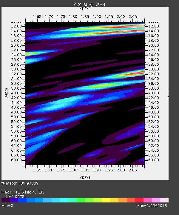
| Arrivals | |
| Ps | 2.1 SECOND |
| PpPs | 5.5 SECOND |
| PsPs/PpSs | 7.6 SECOND |

