You are here: Home > Network List > GM - US Geological Survey Networks Stations List
> Station IWM01 Jericho 2M Well Monitoring Station > Earthquake Result Viewer
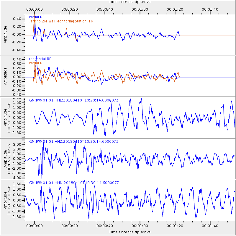
IWM01 Jericho 2M Well Monitoring Station - Earthquake Result Viewer
*The percent match for this event was below the threshold and hence no stack was calculated.
| Earthquake location: |
Near Coast Of Central Chile |
| Earthquake latitude/longitude: |
-31.0/-71.6 |
| Earthquake time(UTC): |
2018/04/10 (100) 10:19:34 GMT |
| Earthquake Depth: |
76 km |
| Earthquake Magnitude: |
6.2 Mww |
| Earthquake Catalog/Contributor: |
NEIC PDE/us |
|
| Network: |
GM US Geological Survey Networks |
| Station: |
IWM01 Jericho 2M Well Monitoring Station |
| Lat/Lon: |
36.73 N/96.53 W |
| Elevation: |
328 m |
|
| Distance: |
71.3 deg |
| Az: |
339.016 deg |
| Baz: |
157.493 deg |
| Ray Param: |
$rayparam |
*The percent match for this event was below the threshold and hence was not used in the summary stack. |
|
| Radial Match: |
54.030674 % |
| Radial Bump: |
400 |
| Transverse Match: |
69.86535 % |
| Transverse Bump: |
400 |
| SOD ConfigId: |
2653092 |
| Insert Time: |
2018-04-24 10:22:08.628 +0000 |
| GWidth: |
2.5 |
| Max Bumps: |
400 |
| Tol: |
0.001 |
|
Signal To Noise
| Channel | StoN | STA | LTA |
| GM:IWM01:01:HHZ:20180410T10:30:14.600007Z | 5.164898 | 1.6652571E-6 | 3.224182E-7 |
| GM:IWM01:01:HHN:20180410T10:30:14.600007Z | 1.7860372 | 6.2027055E-7 | 3.4728868E-7 |
| GM:IWM01:01:HHE:20180410T10:30:14.600007Z | 1.8129144 | 7.452772E-7 | 4.1109342E-7 |
| Arrivals |
| Ps | |
| PpPs | |
| PsPs/PpSs | |


