You are here: Home > Network List > US - United States National Seismic Network Stations List
> Station AGMN Agassiz National Wildlife Refuge, Minnesota, USA > Earthquake Result Viewer
AGMN Agassiz National Wildlife Refuge, Minnesota, USA - Earthquake Result Viewer
*The percent match for this event was below the threshold and hence no stack was calculated.
| Earthquake location: |
Kuril Islands |
| Earthquake latitude/longitude: |
48.3/153.7 |
| Earthquake time(UTC): |
2021/10/11 (284) 23:10:00 GMT |
| Earthquake Depth: |
70 km |
| Earthquake Magnitude: |
5.8 Mww |
| Earthquake Catalog/Contributor: |
NEIC PDE/us |
|
| Network: |
US United States National Seismic Network |
| Station: |
AGMN Agassiz National Wildlife Refuge, Minnesota, USA |
| Lat/Lon: |
48.30 N/95.86 W |
| Elevation: |
351 m |
|
| Distance: |
66.5 deg |
| Az: |
43.041 deg |
| Baz: |
316.96 deg |
| Ray Param: |
$rayparam |
*The percent match for this event was below the threshold and hence was not used in the summary stack. |
|
| Radial Match: |
49.82988 % |
| Radial Bump: |
400 |
| Transverse Match: |
47.504707 % |
| Transverse Bump: |
400 |
| SOD ConfigId: |
26497111 |
| Insert Time: |
2021-10-25 23:32:57.493 +0000 |
| GWidth: |
2.5 |
| Max Bumps: |
400 |
| Tol: |
0.001 |
|
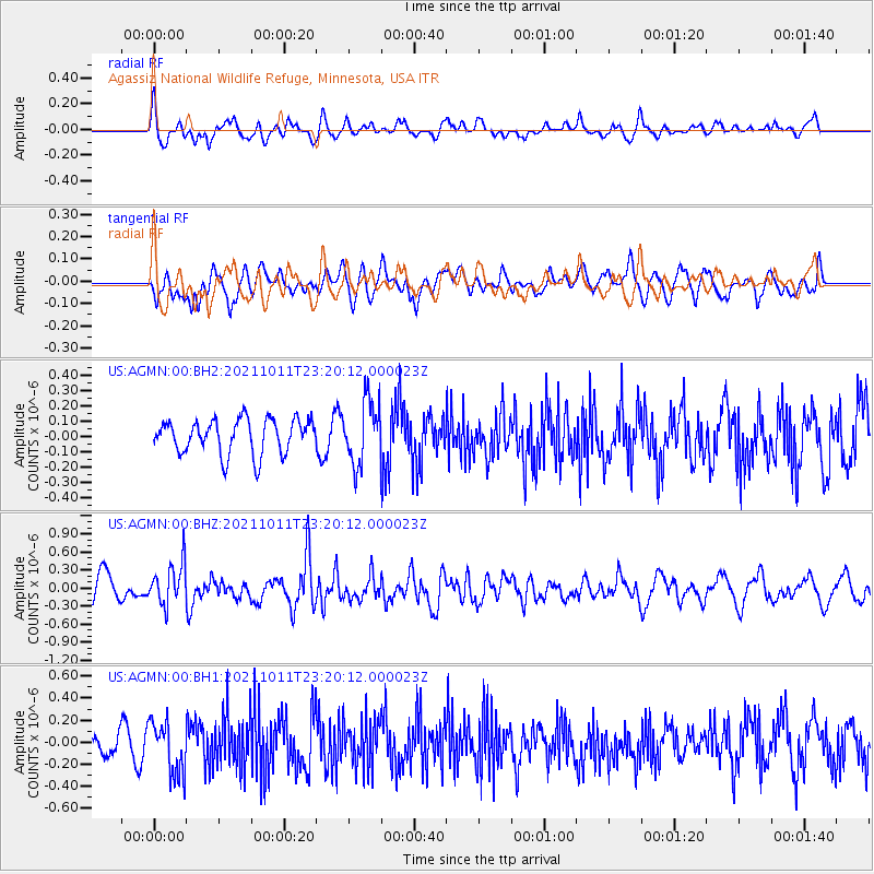
Signal To Noise
| Channel | StoN | STA | LTA |
| US:AGMN:00:BHZ:20211011T23:20:12.000023Z | 1.7844954 | 3.4466018E-7 | 1.9314155E-7 |
| US:AGMN:00:BH1:20211011T23:20:12.000023Z | 1.9518828 | 2.3866198E-7 | 1.222727E-7 |
| US:AGMN:00:BH2:20211011T23:20:12.000023Z | 1.8348489 | 2.0740337E-7 | 1.13035675E-7 |
| Arrivals |
| Ps | |
| PpPs | |
| PsPs/PpSs | |


