
RUMJ YL.RUMJ - Earthquake Result Viewer
| ||||||||||||||||||
| ||||||||||||||||||
| ||||||||||||||||||
|
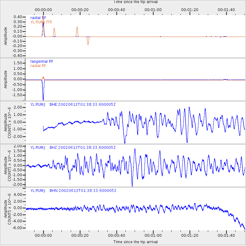
Signal To Noise
| Channel | StoN | STA | LTA |
| YL:RUMJ: :BHZ:20020613T01:38:33.600005Z | 1.6596346 | 1.090744E-7 | 6.5721935E-8 |
| YL:RUMJ: :BHN:20020613T01:38:33.600005Z | 0.94129986 | 4.951343E-7 | 5.2601126E-7 |
| YL:RUMJ: :BHE:20020613T01:38:33.600005Z | 1.0824826 | 3.9030704E-7 | 3.605666E-7 |
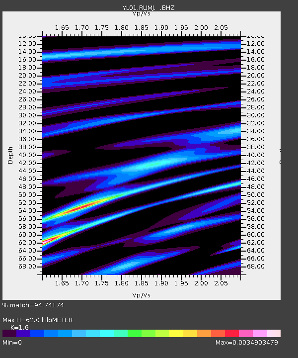
| Arrivals | |
| Ps | 6.2 SECOND |
| PpPs | 25 SECOND |
| PsPs/PpSs | 31 SECOND |

