You are here: Home > Network List > UW - Pacific Northwest Regional Seismic Network Stations List
> Station LTY Liberty (broad-band) > Earthquake Result Viewer
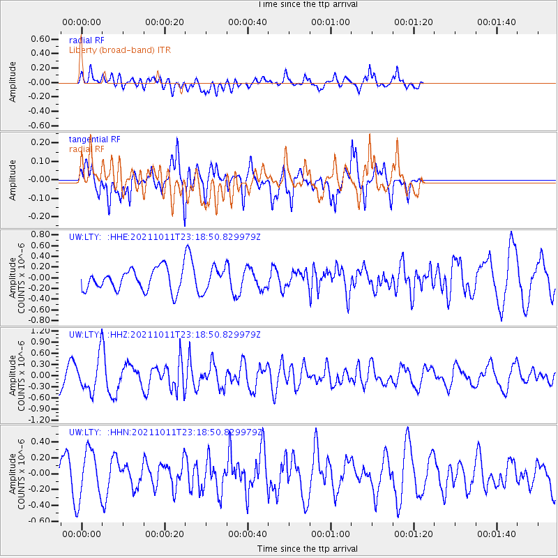
LTY Liberty (broad-band) - Earthquake Result Viewer
*The percent match for this event was below the threshold and hence no stack was calculated.
| Earthquake location: |
Kuril Islands |
| Earthquake latitude/longitude: |
48.3/153.7 |
| Earthquake time(UTC): |
2021/10/11 (284) 23:10:00 GMT |
| Earthquake Depth: |
70 km |
| Earthquake Magnitude: |
5.8 Mww |
| Earthquake Catalog/Contributor: |
NEIC PDE/us |
|
| Network: |
UW Pacific Northwest Regional Seismic Network |
| Station: |
LTY Liberty (broad-band) |
| Lat/Lon: |
47.26 N/120.66 W |
| Elevation: |
970 m |
|
| Distance: |
54.6 deg |
| Az: |
56.481 deg |
| Baz: |
305.189 deg |
| Ray Param: |
$rayparam |
*The percent match for this event was below the threshold and hence was not used in the summary stack. |
|
| Radial Match: |
75.41222 % |
| Radial Bump: |
400 |
| Transverse Match: |
65.11055 % |
| Transverse Bump: |
400 |
| SOD ConfigId: |
26497111 |
| Insert Time: |
2021-10-25 23:34:04.436 +0000 |
| GWidth: |
2.5 |
| Max Bumps: |
400 |
| Tol: |
0.001 |
|
Signal To Noise
| Channel | StoN | STA | LTA |
| UW:LTY: :HHZ:20211011T23:18:50.829979Z | 2.2958155 | 4.5930975E-7 | 2.000639E-7 |
| UW:LTY: :HHN:20211011T23:18:50.829979Z | 2.4125075 | 3.031492E-7 | 1.2565731E-7 |
| UW:LTY: :HHE:20211011T23:18:50.829979Z | 1.0668323 | 2.1290047E-7 | 1.995632E-7 |
| Arrivals |
| Ps | |
| PpPs | |
| PsPs/PpSs | |


