You are here: Home > Network List > IW - Intermountain West Stations List
> Station MOOW Moose Ponds, Wyoming, USA > Earthquake Result Viewer
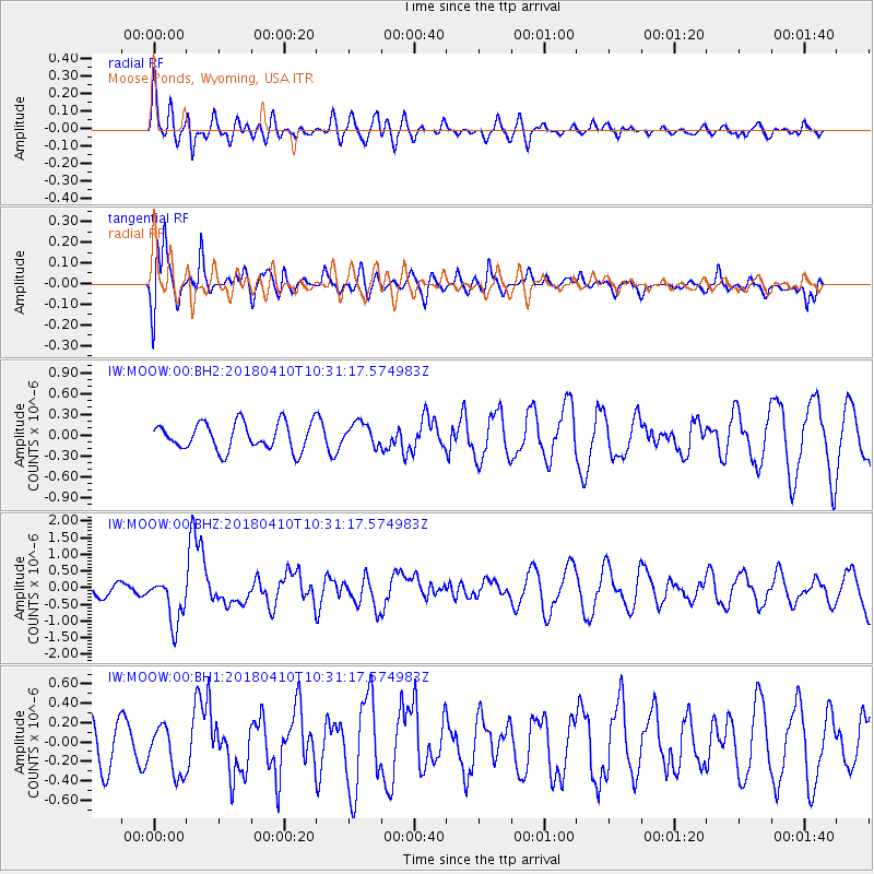
MOOW Moose Ponds, Wyoming, USA - Earthquake Result Viewer
*The percent match for this event was below the threshold and hence no stack was calculated.
| Earthquake location: |
Near Coast Of Central Chile |
| Earthquake latitude/longitude: |
-31.0/-71.6 |
| Earthquake time(UTC): |
2018/04/10 (100) 10:19:34 GMT |
| Earthquake Depth: |
76 km |
| Earthquake Magnitude: |
6.2 Mww |
| Earthquake Catalog/Contributor: |
NEIC PDE/us |
|
| Network: |
IW Intermountain West |
| Station: |
MOOW Moose Ponds, Wyoming, USA |
| Lat/Lon: |
43.75 N/110.74 W |
| Elevation: |
2128 m |
|
| Distance: |
82.6 deg |
| Az: |
332.497 deg |
| Baz: |
146.821 deg |
| Ray Param: |
$rayparam |
*The percent match for this event was below the threshold and hence was not used in the summary stack. |
|
| Radial Match: |
66.590065 % |
| Radial Bump: |
400 |
| Transverse Match: |
60.774395 % |
| Transverse Bump: |
400 |
| SOD ConfigId: |
2653092 |
| Insert Time: |
2018-04-24 10:23:38.640 +0000 |
| GWidth: |
2.5 |
| Max Bumps: |
400 |
| Tol: |
0.001 |
|
Signal To Noise
| Channel | StoN | STA | LTA |
| IW:MOOW:00:BHZ:20180410T10:31:17.574983Z | 2.615702 | 7.036849E-7 | 2.6902336E-7 |
| IW:MOOW:00:BH1:20180410T10:31:17.574983Z | 1.1426569 | 2.4770512E-7 | 2.1677995E-7 |
| IW:MOOW:00:BH2:20180410T10:31:17.574983Z | 0.843067 | 1.65876E-7 | 1.9675305E-7 |
| Arrivals |
| Ps | |
| PpPs | |
| PsPs/PpSs | |


