You are here: Home > Network List > AV - Alaska Volcano Observatory Stations List
> Station AMKA Regional Station, Amchitka Island, Alaska > Earthquake Result Viewer
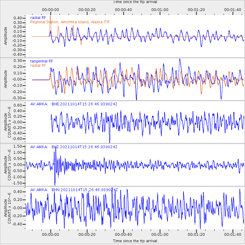
AMKA Regional Station, Amchitka Island, Alaska - Earthquake Result Viewer
*The percent match for this event was below the threshold and hence no stack was calculated.
| Earthquake location: |
Northern Molucca Sea |
| Earthquake latitude/longitude: |
1.2/126.2 |
| Earthquake time(UTC): |
2021/10/14 (287) 15:16:28 GMT |
| Earthquake Depth: |
34 km |
| Earthquake Magnitude: |
5.5 mww |
| Earthquake Catalog/Contributor: |
NEIC PDE/us |
|
| Network: |
AV Alaska Volcano Observatory |
| Station: |
AMKA Regional Station, Amchitka Island, Alaska |
| Lat/Lon: |
51.38 N/179.30 E |
| Elevation: |
116 m |
|
| Distance: |
66.9 deg |
| Az: |
33.034 deg |
| Baz: |
240.414 deg |
| Ray Param: |
$rayparam |
*The percent match for this event was below the threshold and hence was not used in the summary stack. |
|
| Radial Match: |
44.049076 % |
| Radial Bump: |
400 |
| Transverse Match: |
56.79253 % |
| Transverse Bump: |
400 |
| SOD ConfigId: |
26497111 |
| Insert Time: |
2021-10-28 15:19:58.828 +0000 |
| GWidth: |
2.5 |
| Max Bumps: |
400 |
| Tol: |
0.001 |
|
Signal To Noise
| Channel | StoN | STA | LTA |
| AV:AMKA: :BHZ:20211014T15:26:46.939024Z | 3.1983497 | 5.9924065E-7 | 1.8735933E-7 |
| AV:AMKA: :BHN:20211014T15:26:46.939024Z | 0.99390334 | 1.5927216E-7 | 1.6024914E-7 |
| AV:AMKA: :BHE:20211014T15:26:46.939024Z | 1.2744312 | 2.340952E-7 | 1.8368603E-7 |
| Arrivals |
| Ps | |
| PpPs | |
| PsPs/PpSs | |


