You are here: Home > Network List > AV - Alaska Volcano Observatory Stations List
> Station KAVE Katnai Ventifact, Alaska > Earthquake Result Viewer
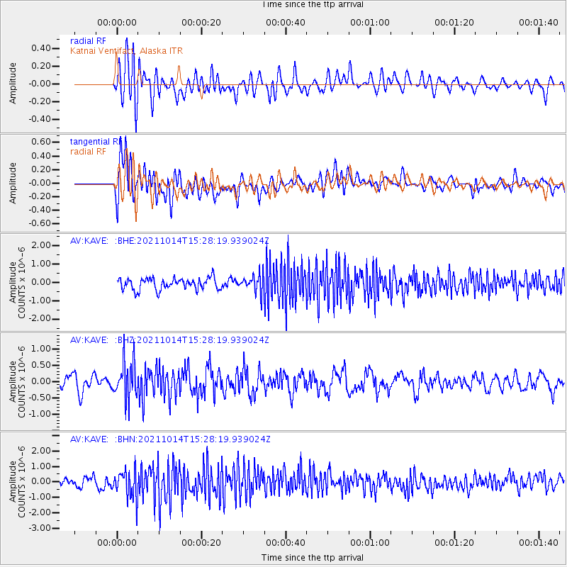
KAVE Katnai Ventifact, Alaska - Earthquake Result Viewer
*The percent match for this event was below the threshold and hence no stack was calculated.
| Earthquake location: |
Northern Molucca Sea |
| Earthquake latitude/longitude: |
1.2/126.2 |
| Earthquake time(UTC): |
2021/10/14 (287) 15:16:28 GMT |
| Earthquake Depth: |
34 km |
| Earthquake Magnitude: |
5.5 mww |
| Earthquake Catalog/Contributor: |
NEIC PDE/us |
|
| Network: |
AV Alaska Volcano Observatory |
| Station: |
KAVE Katnai Ventifact, Alaska |
| Lat/Lon: |
58.20 N/155.02 W |
| Elevation: |
702 m |
|
| Distance: |
83.1 deg |
| Az: |
31.554 deg |
| Baz: |
261.111 deg |
| Ray Param: |
$rayparam |
*The percent match for this event was below the threshold and hence was not used in the summary stack. |
|
| Radial Match: |
52.981956 % |
| Radial Bump: |
400 |
| Transverse Match: |
63.135048 % |
| Transverse Bump: |
400 |
| SOD ConfigId: |
26497111 |
| Insert Time: |
2021-10-28 15:20:29.414 +0000 |
| GWidth: |
2.5 |
| Max Bumps: |
400 |
| Tol: |
0.001 |
|
Signal To Noise
| Channel | StoN | STA | LTA |
| AV:KAVE: :BHZ:20211014T15:28:19.939024Z | 2.8617792 | 5.653034E-7 | 1.9753566E-7 |
| AV:KAVE: :BHN:20211014T15:28:19.939024Z | 3.4141986 | 9.2148133E-7 | 2.6989682E-7 |
| AV:KAVE: :BHE:20211014T15:28:19.939024Z | 1.5431055 | 4.8391064E-7 | 3.135953E-7 |
| Arrivals |
| Ps | |
| PpPs | |
| PsPs/PpSs | |


