You are here: Home > Network List > TX - Texas Seismological Network Stations List
> Station WTFS Witchita Falls > Earthquake Result Viewer
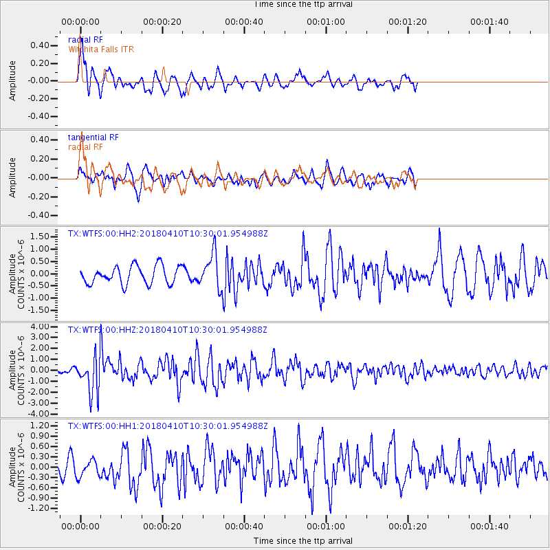
WTFS Witchita Falls - Earthquake Result Viewer
*The percent match for this event was below the threshold and hence no stack was calculated.
| Earthquake location: |
Near Coast Of Central Chile |
| Earthquake latitude/longitude: |
-31.0/-71.6 |
| Earthquake time(UTC): |
2018/04/10 (100) 10:19:34 GMT |
| Earthquake Depth: |
76 km |
| Earthquake Magnitude: |
6.2 Mww |
| Earthquake Catalog/Contributor: |
NEIC PDE/us |
|
| Network: |
TX Texas Seismological Network |
| Station: |
WTFS Witchita Falls |
| Lat/Lon: |
33.77 N/98.46 W |
| Elevation: |
277 m |
|
| Distance: |
69.2 deg |
| Az: |
336.222 deg |
| Baz: |
155.439 deg |
| Ray Param: |
$rayparam |
*The percent match for this event was below the threshold and hence was not used in the summary stack. |
|
| Radial Match: |
71.656425 % |
| Radial Bump: |
400 |
| Transverse Match: |
58.010536 % |
| Transverse Bump: |
400 |
| SOD ConfigId: |
2653092 |
| Insert Time: |
2018-04-24 10:25:38.064 +0000 |
| GWidth: |
2.5 |
| Max Bumps: |
400 |
| Tol: |
0.001 |
|
Signal To Noise
| Channel | StoN | STA | LTA |
| TX:WTFS:00:HHZ:20180410T10:30:01.954988Z | 6.3272605 | 1.6609652E-6 | 2.6250936E-7 |
| TX:WTFS:00:HH1:20180410T10:30:01.954988Z | 0.88602954 | 2.9149368E-7 | 3.2898868E-7 |
| TX:WTFS:00:HH2:20180410T10:30:01.954988Z | 2.0130293 | 7.3458943E-7 | 3.6491738E-7 |
| Arrivals |
| Ps | |
| PpPs | |
| PsPs/PpSs | |


