You are here: Home > Network List > YL01 - Himalayan Nepal Tibet Experiment Stations List
> Station RUMJ YL.RUMJ > Earthquake Result Viewer
RUMJ YL.RUMJ - Earthquake Result Viewer

| Earthquake location: |
Southern Sumatra, Indonesia |
| Earthquake latitude/longitude: |
-2.3/102.6 |
| Earthquake time(UTC): |
2002/06/16 (167) 18:31:10 GMT |
| Earthquake Depth: |
232 km |
| Earthquake Magnitude: |
5.8 MW, 5.4 MB, 5.7 MW |
| Earthquake Catalog/Contributor: |
WHDF/NEIC |
|
| Network: |
YL Himalayan Nepal Tibet Experiment |
| Station: |
RUMJ YL.RUMJ |
| Lat/Lon: |
27.30 N/86.55 E |
| Elevation: |
1319 m |
|
| Distance: |
33.3 deg |
| Az: |
333.421 deg |
| Baz: |
149.84 deg |
| Ray Param: |
0.0774954 |
| Estimated Moho Depth: |
25.75 km |
| Estimated Crust Vp/Vs: |
1.61 |
| Assumed Crust Vp: |
6.236 km/s |
| Estimated Crust Vs: |
3.879 km/s |
| Estimated Crust Poisson's Ratio: |
0.18 |
|
| Radial Match: |
83.71779 % |
| Radial Bump: |
400 |
| Transverse Match: |
73.62164 % |
| Transverse Bump: |
400 |
| SOD ConfigId: |
16844 |
| Insert Time: |
2010-02-26 16:07:00.599 +0000 |
| GWidth: |
2.5 |
| Max Bumps: |
400 |
| Tol: |
0.001 |
|
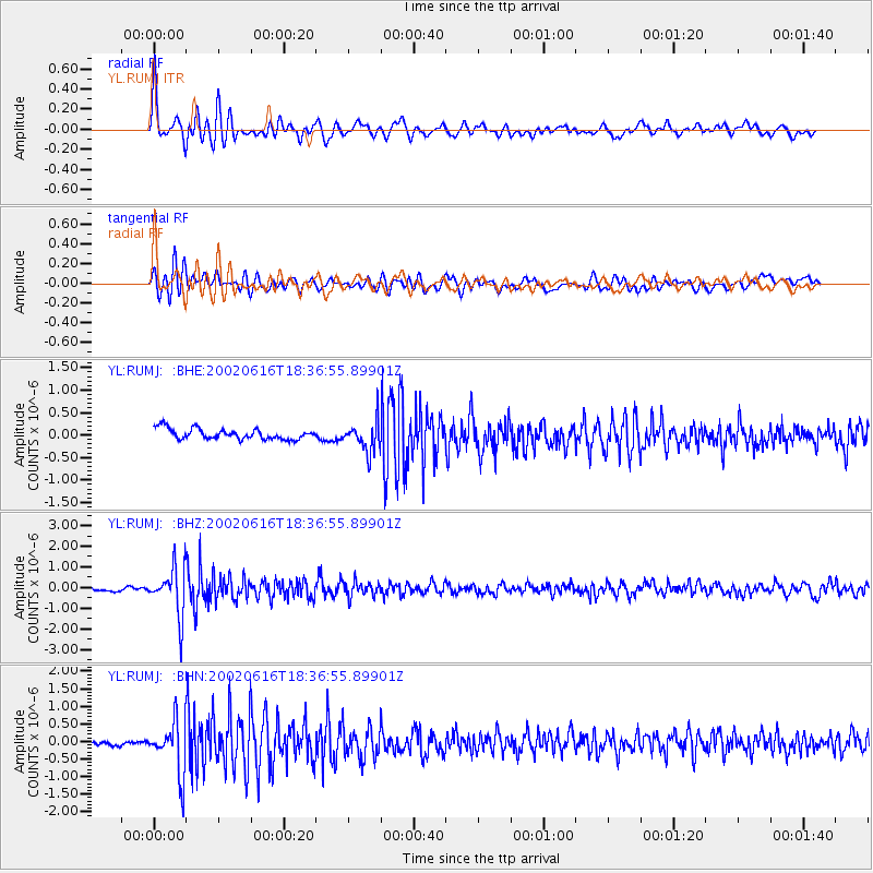
Signal To Noise
| Channel | StoN | STA | LTA |
| YL:RUMJ: :BHZ:20020616T18:36:55.89901Z | 9.456312 | 1.1335743E-6 | 1.1987488E-7 |
| YL:RUMJ: :BHN:20020616T18:36:55.89901Z | 12.68757 | 7.5131965E-7 | 5.9216987E-8 |
| YL:RUMJ: :BHE:20020616T18:36:55.89901Z | 2.8556635 | 3.3425297E-7 | 1.1704915E-7 |
| Arrivals |
| Ps | 2.7 SECOND |
| PpPs | 9.9 SECOND |
| PsPs/PpSs | 13 SECOND |


