RUMJ YL.RUMJ - Earthquake Result Viewer
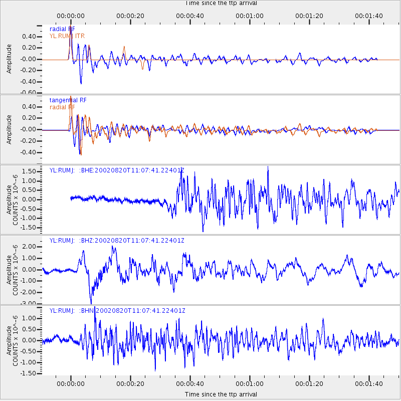
Earthquake location: Southeast Of Honshu, Japan
Earthquake latitude/longitude: 31.0/142.0
Earthquake time(UTC): 2002/08/20 (232) 10:59:32 GMT
Earthquake Depth: 9.0 km
Earthquake Magnitude: 5.4 MB, 6.2 MS, 6.3 MW, 6.1 MW
Earthquake Catalog/Contributor: WHDF/NEIC
Network: YL Himalayan Nepal Tibet Experiment
Station: RUMJ YL.RUMJ
Lat/Lon: 27.30 N/86.55 E
Elevation: 1319 m
Distance: 48.1 deg
Az: 280.299 deg
Baz: 71.729 deg
Ray Param: 0.06956044
Estimated Moho Depth: 13.5 km
Estimated Crust Vp/Vs: 2.10
Assumed Crust Vp: 6.236 km/s
Estimated Crust Vs: 2.977 km/s
Estimated Crust Poisson's Ratio: 0.35
Radial Match: 86.31128 %
Radial Bump: 400
Transverse Match: 72.84222 %
Transverse Bump: 400
SOD ConfigId: 16844
Insert Time: 2010-02-26 16:07:02.017 +0000
GWidth: 2.5
Max Bumps: 400
Tol: 0.001

Signal To Noise

ChannelStoNSTALTA
YL:RUMJ: :BHZ:20020820T11:07:41.22401Z4.95017246.4854555E-71.3101473E-7
YL:RUMJ: :BHN:20020820T11:07:41.22401Z1.85527232.6328553E-71.4191208E-7
YL:RUMJ: :BHE:20020820T11:07:41.22401Z4.3880584.003866E-79.1244594E-8
Arrivals
Ps2.5 SECOND
PpPs6.4 SECOND
PsPs/PpSs8.9 SECOND