RUMJ YL.RUMJ - Earthquake Result Viewer
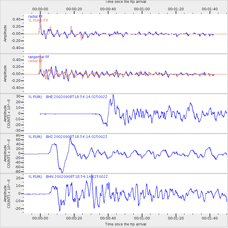
Earthquake location: Near N Coast Of New Guinea, P.N.G.
Earthquake latitude/longitude: -3.3/142.9
Earthquake time(UTC): 2002/09/08 (251) 18:44:23 GMT
Earthquake Depth: 13 km
Earthquake Magnitude: 6.5 MB, 7.8 MS, 7.6 MW, 7.3 MW
Earthquake Catalog/Contributor: WHDF/NEIC
Network: YL Himalayan Nepal Tibet Experiment
Station: RUMJ YL.RUMJ
Lat/Lon: 27.30 N/86.55 E
Elevation: 1319 m
Distance: 62.3 deg
Az: 303.131 deg
Baz: 110.022 deg
Ray Param: 0.060341537
Estimated Moho Depth: 41.75 km
Estimated Crust Vp/Vs: 1.92
Assumed Crust Vp: 6.236 km/s
Estimated Crust Vs: 3.248 km/s
Estimated Crust Poisson's Ratio: 0.31
Radial Match: 89.9541 %
Radial Bump: 400
Transverse Match: 77.738335 %
Transverse Bump: 400
SOD ConfigId: 16844
Insert Time: 2010-02-26 16:07:05.717 +0000
GWidth: 2.5
Max Bumps: 400
Tol: 0.001

Signal To Noise

ChannelStoNSTALTA
YL:RUMJ: :BHZ:20020908T18:54:14.025002Z6.0364625.446498E-79.022666E-8
YL:RUMJ: :BHN:20020908T18:54:14.025002Z2.53343751.2961742E-75.1162672E-8
YL:RUMJ: :BHE:20020908T18:54:14.025002Z1.91211571.5352174E-78.0288935E-8
Arrivals
Ps6.4 SECOND
PpPs19 SECOND
PsPs/PpSs25 SECOND