You are here: Home > Network List > US - United States National Seismic Network Stations List
> Station DGMT Dagmar, Montana, USA > Earthquake Result Viewer
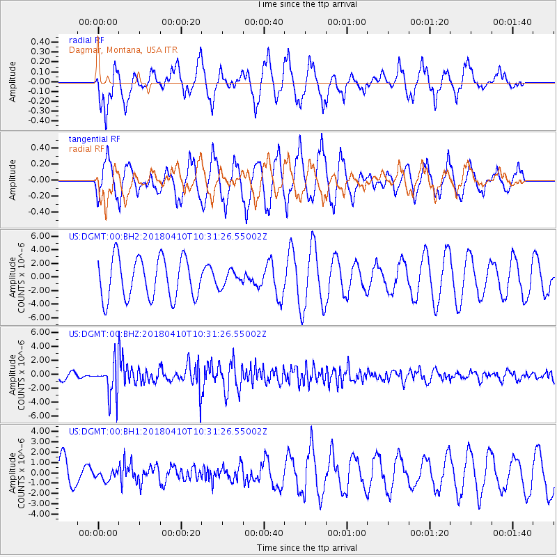
DGMT Dagmar, Montana, USA - Earthquake Result Viewer
*The percent match for this event was below the threshold and hence no stack was calculated.
| Earthquake location: |
Near Coast Of Central Chile |
| Earthquake latitude/longitude: |
-31.0/-71.6 |
| Earthquake time(UTC): |
2018/04/10 (100) 10:19:34 GMT |
| Earthquake Depth: |
76 km |
| Earthquake Magnitude: |
6.2 Mww |
| Earthquake Catalog/Contributor: |
NEIC PDE/us |
|
| Network: |
US United States National Seismic Network |
| Station: |
DGMT Dagmar, Montana, USA |
| Lat/Lon: |
48.47 N/104.20 W |
| Elevation: |
0.0 m |
|
| Distance: |
84.3 deg |
| Az: |
338.857 deg |
| Baz: |
152.259 deg |
| Ray Param: |
$rayparam |
*The percent match for this event was below the threshold and hence was not used in the summary stack. |
|
| Radial Match: |
87.76266 % |
| Radial Bump: |
398 |
| Transverse Match: |
65.93065 % |
| Transverse Bump: |
400 |
| SOD ConfigId: |
2653092 |
| Insert Time: |
2018-04-24 10:26:25.918 +0000 |
| GWidth: |
2.5 |
| Max Bumps: |
400 |
| Tol: |
0.001 |
|
Signal To Noise
| Channel | StoN | STA | LTA |
| US:DGMT:00:BHZ:20180410T10:31:26.55002Z | 3.9523356 | 2.4315982E-6 | 6.152307E-7 |
| US:DGMT:00:BH1:20180410T10:31:26.55002Z | 0.3243171 | 4.6187077E-7 | 1.4241333E-6 |
| US:DGMT:00:BH2:20180410T10:31:26.55002Z | 0.37027735 | 1.111494E-6 | 3.001788E-6 |
| Arrivals |
| Ps | |
| PpPs | |
| PsPs/PpSs | |


