You are here: Home > Network List > UW - Pacific Northwest Regional Seismic Network Stations List
> Station IRON Crane, OR, USA > Earthquake Result Viewer
IRON Crane, OR, USA - Earthquake Result Viewer
*The percent match for this event was below the threshold and hence no stack was calculated.
| Earthquake location: |
Solomon Islands |
| Earthquake latitude/longitude: |
-8.9/158.5 |
| Earthquake time(UTC): |
2021/10/15 (288) 02:44:57 GMT |
| Earthquake Depth: |
23 km |
| Earthquake Magnitude: |
6.4 mww |
| Earthquake Catalog/Contributor: |
NEIC PDE/us |
|
| Network: |
UW Pacific Northwest Regional Seismic Network |
| Station: |
IRON Crane, OR, USA |
| Lat/Lon: |
43.36 N/118.47 W |
| Elevation: |
1226 m |
|
| Distance: |
91.0 deg |
| Az: |
46.396 deg |
| Baz: |
258.83 deg |
| Ray Param: |
$rayparam |
*The percent match for this event was below the threshold and hence was not used in the summary stack. |
|
| Radial Match: |
51.64388 % |
| Radial Bump: |
389 |
| Transverse Match: |
52.3447 % |
| Transverse Bump: |
400 |
| SOD ConfigId: |
26497111 |
| Insert Time: |
2021-10-29 03:01:43.940 +0000 |
| GWidth: |
2.5 |
| Max Bumps: |
400 |
| Tol: |
0.001 |
|
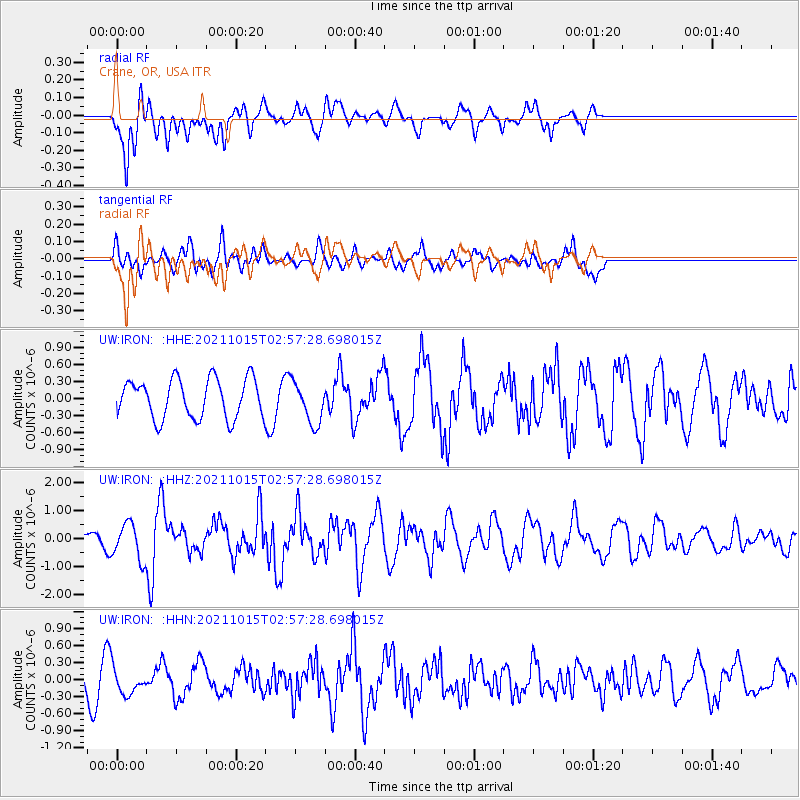
Signal To Noise
| Channel | StoN | STA | LTA |
| UW:IRON: :HHZ:20211015T02:57:28.698015Z | 2.013619 | 6.3529734E-7 | 3.155003E-7 |
| UW:IRON: :HHN:20211015T02:57:28.698015Z | 1.0448567 | 2.3278663E-7 | 2.2279289E-7 |
| UW:IRON: :HHE:20211015T02:57:28.698015Z | 1.0901848 | 3.7232417E-7 | 3.415239E-7 |
| Arrivals |
| Ps | |
| PpPs | |
| PsPs/PpSs | |


