You are here: Home > Network List > US - United States National Seismic Network Stations List
> Station MSO Missoula, Montana, USA > Earthquake Result Viewer
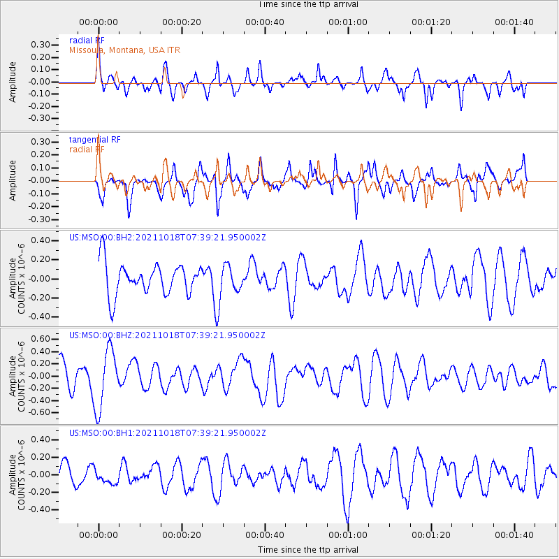
MSO Missoula, Montana, USA - Earthquake Result Viewer
*The percent match for this event was below the threshold and hence no stack was calculated.
| Earthquake location: |
Vanuatu Islands |
| Earthquake latitude/longitude: |
-13.7/166.9 |
| Earthquake time(UTC): |
2021/10/18 (291) 07:26:52 GMT |
| Earthquake Depth: |
96 km |
| Earthquake Magnitude: |
6.1 Mww |
| Earthquake Catalog/Contributor: |
NEIC PDE/us |
|
| Network: |
US United States National Seismic Network |
| Station: |
MSO Missoula, Montana, USA |
| Lat/Lon: |
46.83 N/113.94 W |
| Elevation: |
1264 m |
|
| Distance: |
92.6 deg |
| Az: |
42.452 deg |
| Baz: |
252.8 deg |
| Ray Param: |
$rayparam |
*The percent match for this event was below the threshold and hence was not used in the summary stack. |
|
| Radial Match: |
54.67021 % |
| Radial Bump: |
358 |
| Transverse Match: |
62.558025 % |
| Transverse Bump: |
400 |
| SOD ConfigId: |
26497111 |
| Insert Time: |
2021-11-01 07:44:57.958 +0000 |
| GWidth: |
2.5 |
| Max Bumps: |
400 |
| Tol: |
0.001 |
|
Signal To Noise
| Channel | StoN | STA | LTA |
| US:MSO:00:BHZ:20211018T07:39:21.950002Z | 2.4325225 | 4.9286297E-7 | 2.0261393E-7 |
| US:MSO:00:BH1:20211018T07:39:21.950002Z | 0.43400887 | 7.530647E-8 | 1.7351367E-7 |
| US:MSO:00:BH2:20211018T07:39:21.950002Z | 0.8477067 | 1.4188383E-7 | 1.6737373E-7 |
| Arrivals |
| Ps | |
| PpPs | |
| PsPs/PpSs | |


