You are here: Home > Network List > UW - Pacific Northwest Regional Seismic Network Stations List
> Station HOOD Mt Hood Meadows, OR CREST BB SMO > Earthquake Result Viewer
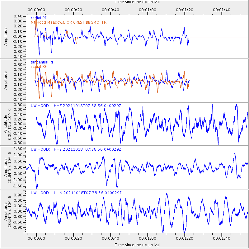
HOOD Mt Hood Meadows, OR CREST BB SMO - Earthquake Result Viewer
*The percent match for this event was below the threshold and hence no stack was calculated.
| Earthquake location: |
Vanuatu Islands |
| Earthquake latitude/longitude: |
-13.7/166.9 |
| Earthquake time(UTC): |
2021/10/18 (291) 07:26:52 GMT |
| Earthquake Depth: |
96 km |
| Earthquake Magnitude: |
6.1 Mww |
| Earthquake Catalog/Contributor: |
NEIC PDE/us |
|
| Network: |
UW Pacific Northwest Regional Seismic Network |
| Station: |
HOOD Mt Hood Meadows, OR CREST BB SMO |
| Lat/Lon: |
45.32 N/121.65 W |
| Elevation: |
1520 m |
|
| Distance: |
87.1 deg |
| Az: |
42.034 deg |
| Baz: |
247.257 deg |
| Ray Param: |
$rayparam |
*The percent match for this event was below the threshold and hence was not used in the summary stack. |
|
| Radial Match: |
76.95146 % |
| Radial Bump: |
400 |
| Transverse Match: |
66.42681 % |
| Transverse Bump: |
400 |
| SOD ConfigId: |
26497111 |
| Insert Time: |
2021-11-01 07:45:54.839 +0000 |
| GWidth: |
2.5 |
| Max Bumps: |
400 |
| Tol: |
0.001 |
|
Signal To Noise
| Channel | StoN | STA | LTA |
| UW:HOOD: :HHZ:20211018T07:38:56.040029Z | 4.47874 | 8.437521E-7 | 1.883905E-7 |
| UW:HOOD: :HHN:20211018T07:38:56.040029Z | 1.4607635 | 3.0549788E-7 | 2.0913576E-7 |
| UW:HOOD: :HHE:20211018T07:38:56.040029Z | 0.9615795 | 3.3750018E-7 | 3.509852E-7 |
| Arrivals |
| Ps | |
| PpPs | |
| PsPs/PpSs | |


