You are here: Home > Network List > UW - Pacific Northwest Regional Seismic Network Stations List
> Station WOLL Wollman Farm, Schrag, WA, USA > Earthquake Result Viewer
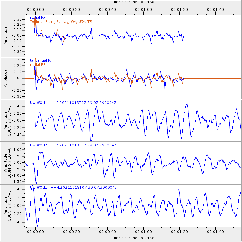
WOLL Wollman Farm, Schrag, WA, USA - Earthquake Result Viewer
*The percent match for this event was below the threshold and hence no stack was calculated.
| Earthquake location: |
Vanuatu Islands |
| Earthquake latitude/longitude: |
-13.7/166.9 |
| Earthquake time(UTC): |
2021/10/18 (291) 07:26:52 GMT |
| Earthquake Depth: |
96 km |
| Earthquake Magnitude: |
6.1 Mww |
| Earthquake Catalog/Contributor: |
NEIC PDE/us |
|
| Network: |
UW Pacific Northwest Regional Seismic Network |
| Station: |
WOLL Wollman Farm, Schrag, WA, USA |
| Lat/Lon: |
47.06 N/118.92 W |
| Elevation: |
385 m |
|
| Distance: |
89.5 deg |
| Az: |
41.126 deg |
| Baz: |
249.195 deg |
| Ray Param: |
$rayparam |
*The percent match for this event was below the threshold and hence was not used in the summary stack. |
|
| Radial Match: |
61.44068 % |
| Radial Bump: |
261 |
| Transverse Match: |
71.683235 % |
| Transverse Bump: |
400 |
| SOD ConfigId: |
26497111 |
| Insert Time: |
2021-11-01 07:47:05.959 +0000 |
| GWidth: |
2.5 |
| Max Bumps: |
400 |
| Tol: |
0.001 |
|
Signal To Noise
| Channel | StoN | STA | LTA |
| UW:WOLL: :HHZ:20211018T07:39:07.390004Z | 4.916908 | 8.322074E-7 | 1.6925422E-7 |
| UW:WOLL: :HHN:20211018T07:39:07.390004Z | 2.2113636 | 2.577397E-7 | 1.1655239E-7 |
| UW:WOLL: :HHE:20211018T07:39:07.390004Z | 2.3653421 | 3.4064374E-7 | 1.4401458E-7 |
| Arrivals |
| Ps | |
| PpPs | |
| PsPs/PpSs | |


