You are here: Home > Network List > AV - Alaska Volcano Observatory Stations List
> Station PLBL Mt. Peulik Volcano, Alaska > Earthquake Result Viewer
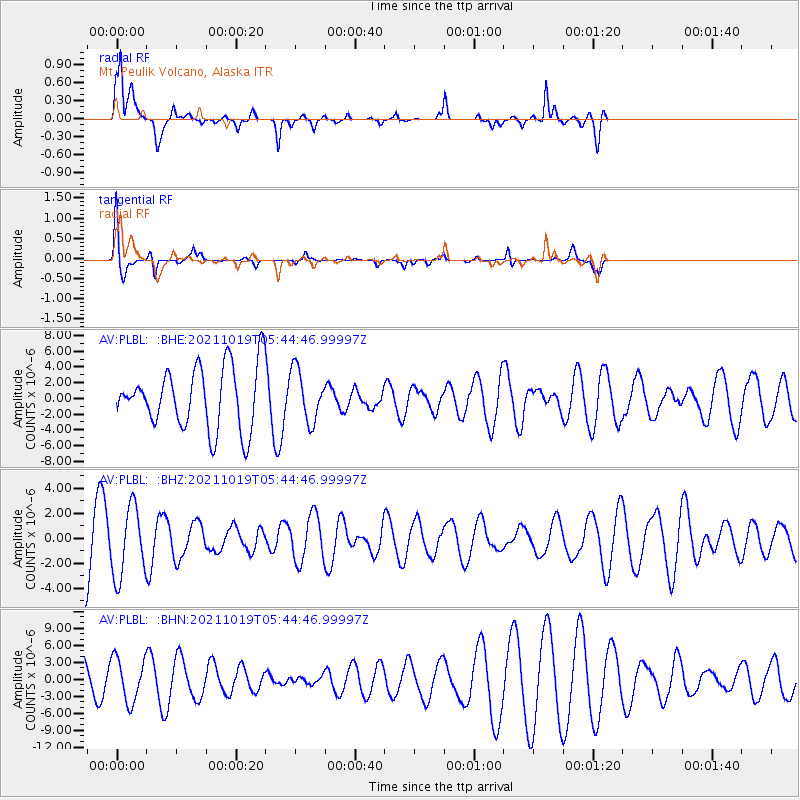
PLBL Mt. Peulik Volcano, Alaska - Earthquake Result Viewer
*The percent match for this event was below the threshold and hence no stack was calculated.
| Earthquake location: |
Eastern Mediterranean Sea |
| Earthquake latitude/longitude: |
34.6/28.4 |
| Earthquake time(UTC): |
2021/10/19 (292) 05:32:32 GMT |
| Earthquake Depth: |
42 km |
| Earthquake Magnitude: |
5.9 mww |
| Earthquake Catalog/Contributor: |
NEIC PDE/us |
|
| Network: |
AV Alaska Volcano Observatory |
| Station: |
PLBL Mt. Peulik Volcano, Alaska |
| Lat/Lon: |
57.70 N/156.82 W |
| Elevation: |
461 m |
|
| Distance: |
88.0 deg |
| Az: |
2.796 deg |
| Baz: |
355.701 deg |
| Ray Param: |
$rayparam |
*The percent match for this event was below the threshold and hence was not used in the summary stack. |
|
| Radial Match: |
35.894966 % |
| Radial Bump: |
228 |
| Transverse Match: |
79.374725 % |
| Transverse Bump: |
178 |
| SOD ConfigId: |
26497111 |
| Insert Time: |
2021-11-02 05:36:53.136 +0000 |
| GWidth: |
2.5 |
| Max Bumps: |
400 |
| Tol: |
0.001 |
|
Signal To Noise
| Channel | StoN | STA | LTA |
| AV:PLBL: :BHZ:20211019T05:44:46.99997Z | 1.3685389 | 2.7862109E-6 | 2.0359018E-6 |
| AV:PLBL: :BHN:20211019T05:44:46.99997Z | 1.6886758 | 3.874296E-6 | 2.2942806E-6 |
| AV:PLBL: :BHE:20211019T05:44:46.99997Z | 0.83381474 | 3.262031E-6 | 3.9121774E-6 |
| Arrivals |
| Ps | |
| PpPs | |
| PsPs/PpSs | |


