You are here: Home > Network List > NE - New England Seismic Network Stations List
> Station EMMW Machias, ME, USA > Earthquake Result Viewer
EMMW Machias, ME, USA - Earthquake Result Viewer
*The percent match for this event was below the threshold and hence no stack was calculated.
| Earthquake location: |
Eastern Mediterranean Sea |
| Earthquake latitude/longitude: |
34.6/28.4 |
| Earthquake time(UTC): |
2021/10/19 (292) 05:32:32 GMT |
| Earthquake Depth: |
42 km |
| Earthquake Magnitude: |
5.9 mww |
| Earthquake Catalog/Contributor: |
NEIC PDE/us |
|
| Network: |
NE New England Seismic Network |
| Station: |
EMMW Machias, ME, USA |
| Lat/Lon: |
44.71 N/67.46 W |
| Elevation: |
35 m |
|
| Distance: |
70.4 deg |
| Az: |
311.13 deg |
| Baz: |
60.632 deg |
| Ray Param: |
$rayparam |
*The percent match for this event was below the threshold and hence was not used in the summary stack. |
|
| Radial Match: |
56.75599 % |
| Radial Bump: |
400 |
| Transverse Match: |
53.619076 % |
| Transverse Bump: |
400 |
| SOD ConfigId: |
26497111 |
| Insert Time: |
2021-11-02 05:44:36.570 +0000 |
| GWidth: |
2.5 |
| Max Bumps: |
400 |
| Tol: |
0.001 |
|
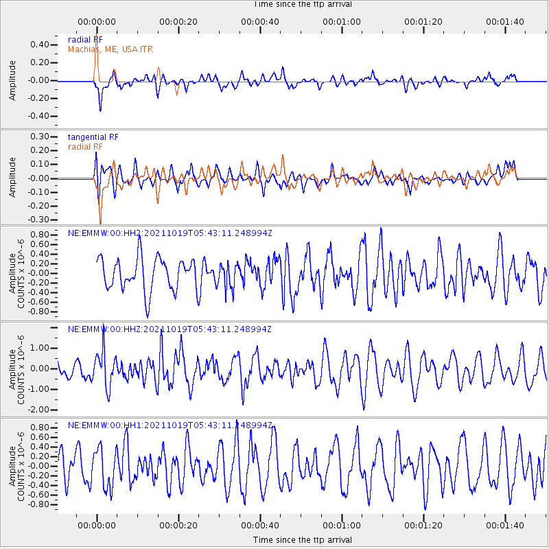
Signal To Noise
| Channel | StoN | STA | LTA |
| NE:EMMW:00:HHZ:20211019T05:43:11.248994Z | 2.042884 | 8.7167075E-7 | 4.2668634E-7 |
| NE:EMMW:00:HH1:20211019T05:43:11.248994Z | 1.3573159 | 4.0906187E-7 | 3.013756E-7 |
| NE:EMMW:00:HH2:20211019T05:43:11.248994Z | 0.7527369 | 2.532909E-7 | 3.3649323E-7 |
| Arrivals |
| Ps | |
| PpPs | |
| PsPs/PpSs | |


