You are here: Home > Network List > US - United States National Seismic Network Stations List
> Station BW06 Boulder Array Site 6 (Pinedale), Wyoming, USA > Earthquake Result Viewer
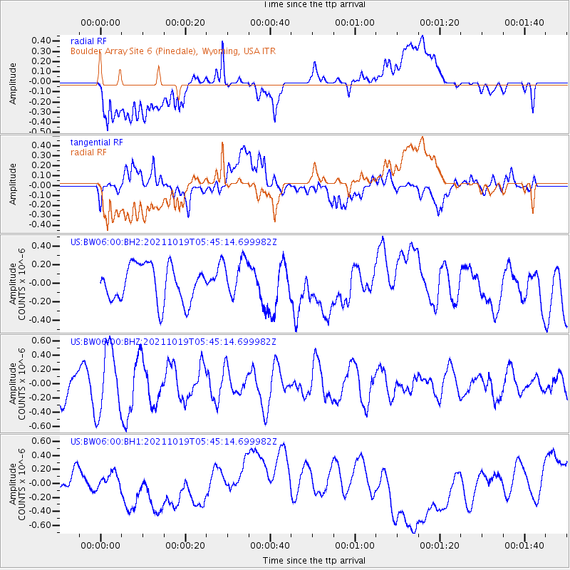
BW06 Boulder Array Site 6 (Pinedale), Wyoming, USA - Earthquake Result Viewer
*The percent match for this event was below the threshold and hence no stack was calculated.
| Earthquake location: |
Eastern Mediterranean Sea |
| Earthquake latitude/longitude: |
34.6/28.4 |
| Earthquake time(UTC): |
2021/10/19 (292) 05:32:32 GMT |
| Earthquake Depth: |
42 km |
| Earthquake Magnitude: |
5.9 mww |
| Earthquake Catalog/Contributor: |
NEIC PDE/us |
|
| Network: |
US United States National Seismic Network |
| Station: |
BW06 Boulder Array Site 6 (Pinedale), Wyoming, USA |
| Lat/Lon: |
42.77 N/109.56 W |
| Elevation: |
2224 m |
|
| Distance: |
93.9 deg |
| Az: |
330.368 deg |
| Baz: |
33.638 deg |
| Ray Param: |
$rayparam |
*The percent match for this event was below the threshold and hence was not used in the summary stack. |
|
| Radial Match: |
31.34161 % |
| Radial Bump: |
400 |
| Transverse Match: |
44.852825 % |
| Transverse Bump: |
400 |
| SOD ConfigId: |
26497111 |
| Insert Time: |
2021-11-02 05:48:34.795 +0000 |
| GWidth: |
2.5 |
| Max Bumps: |
400 |
| Tol: |
0.001 |
|
Signal To Noise
| Channel | StoN | STA | LTA |
| US:BW06:00:BHZ:20211019T05:45:14.699982Z | 2.4003208 | 4.508625E-7 | 1.8783427E-7 |
| US:BW06:00:BH1:20211019T05:45:14.699982Z | 0.38315183 | 9.442953E-8 | 2.464546E-7 |
| US:BW06:00:BH2:20211019T05:45:14.699982Z | 1.0281341 | 2.0153072E-7 | 1.9601598E-7 |
| Arrivals |
| Ps | |
| PpPs | |
| PsPs/PpSs | |


