You are here: Home > Network List > US - United States National Seismic Network Stations List
> Station ERPA Erie, Pennsylvania, USA > Earthquake Result Viewer
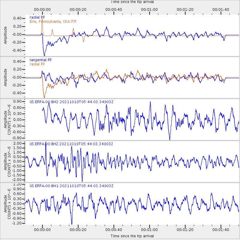
ERPA Erie, Pennsylvania, USA - Earthquake Result Viewer
*The percent match for this event was below the threshold and hence no stack was calculated.
| Earthquake location: |
Eastern Mediterranean Sea |
| Earthquake latitude/longitude: |
34.6/28.4 |
| Earthquake time(UTC): |
2021/10/19 (292) 05:32:32 GMT |
| Earthquake Depth: |
42 km |
| Earthquake Magnitude: |
5.9 mww |
| Earthquake Catalog/Contributor: |
NEIC PDE/us |
|
| Network: |
US United States National Seismic Network |
| Station: |
ERPA Erie, Pennsylvania, USA |
| Lat/Lon: |
42.12 N/79.99 W |
| Elevation: |
306 m |
|
| Distance: |
79.4 deg |
| Az: |
314.083 deg |
| Baz: |
52.803 deg |
| Ray Param: |
$rayparam |
*The percent match for this event was below the threshold and hence was not used in the summary stack. |
|
| Radial Match: |
64.54501 % |
| Radial Bump: |
400 |
| Transverse Match: |
64.51007 % |
| Transverse Bump: |
400 |
| SOD ConfigId: |
26497111 |
| Insert Time: |
2021-11-02 05:48:40.821 +0000 |
| GWidth: |
2.5 |
| Max Bumps: |
400 |
| Tol: |
0.001 |
|
Signal To Noise
| Channel | StoN | STA | LTA |
| US:ERPA:00:BHZ:20211019T05:44:03.34903Z | 2.2208858 | 7.8606706E-7 | 3.5394305E-7 |
| US:ERPA:00:BH1:20211019T05:44:03.34903Z | 0.84923035 | 2.308746E-7 | 2.7186334E-7 |
| US:ERPA:00:BH2:20211019T05:44:03.34903Z | 1.4759684 | 4.3844665E-7 | 2.9705694E-7 |
| Arrivals |
| Ps | |
| PpPs | |
| PsPs/PpSs | |


