You are here: Home > Network List > G - GEOSCOPE Stations List
> Station INU Inuyama, Japan > Earthquake Result Viewer
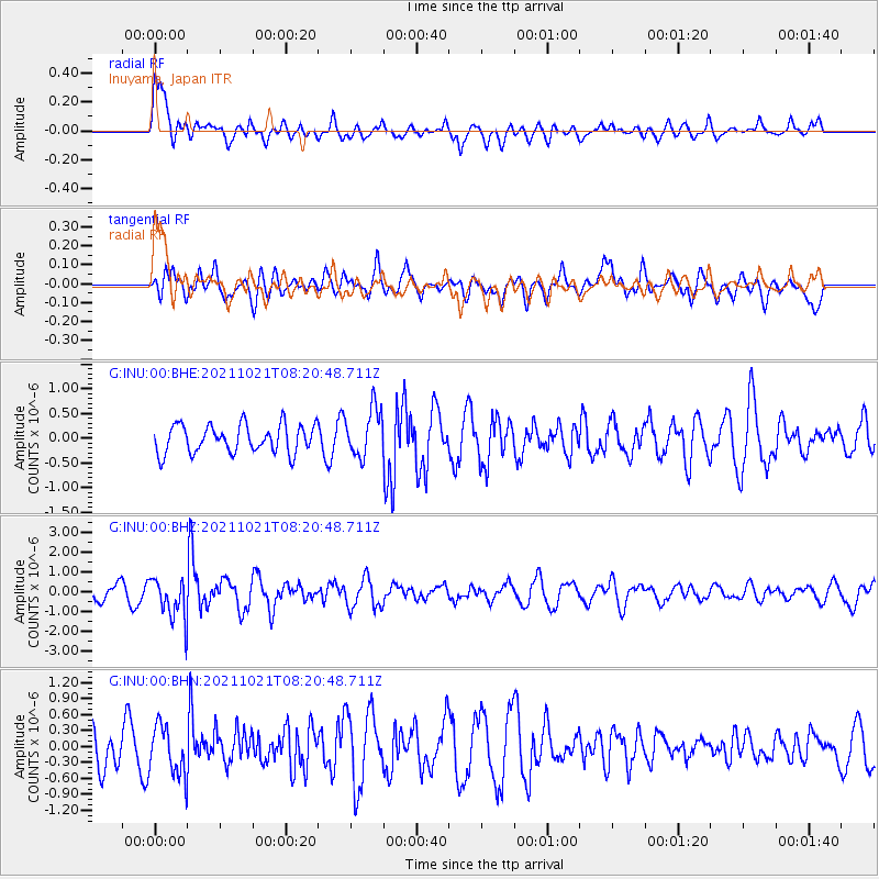
INU Inuyama, Japan - Earthquake Result Viewer
*The percent match for this event was below the threshold and hence no stack was calculated.
| Earthquake location: |
South Of Fiji Islands |
| Earthquake latitude/longitude: |
-25.2/179.6 |
| Earthquake time(UTC): |
2021/10/21 (294) 08:10:43 GMT |
| Earthquake Depth: |
497 km |
| Earthquake Magnitude: |
6.0 mww |
| Earthquake Catalog/Contributor: |
NEIC PDE/us |
|
| Network: |
G GEOSCOPE |
| Station: |
INU Inuyama, Japan |
| Lat/Lon: |
35.35 N/137.03 E |
| Elevation: |
132 m |
|
| Distance: |
72.5 deg |
| Az: |
324.528 deg |
| Baz: |
139.992 deg |
| Ray Param: |
$rayparam |
*The percent match for this event was below the threshold and hence was not used in the summary stack. |
|
| Radial Match: |
63.34255 % |
| Radial Bump: |
400 |
| Transverse Match: |
57.23345 % |
| Transverse Bump: |
400 |
| SOD ConfigId: |
26497111 |
| Insert Time: |
2021-11-04 08:18:00.171 +0000 |
| GWidth: |
2.5 |
| Max Bumps: |
400 |
| Tol: |
0.001 |
|
Signal To Noise
| Channel | StoN | STA | LTA |
| G:INU:00:BHZ:20211021T08:20:48.711Z | 3.4728277 | 1.0599695E-6 | 3.0521798E-7 |
| G:INU:00:BHN:20211021T08:20:48.711Z | 0.9133634 | 4.680823E-7 | 5.12482E-7 |
| G:INU:00:BHE:20211021T08:20:48.711Z | 1.7360419 | 4.875558E-7 | 2.8084332E-7 |
| Arrivals |
| Ps | |
| PpPs | |
| PsPs/PpSs | |


