You are here: Home > Network List > US - United States National Seismic Network Stations List
> Station DUG Dugway, Tooele County, Utah, USA > Earthquake Result Viewer
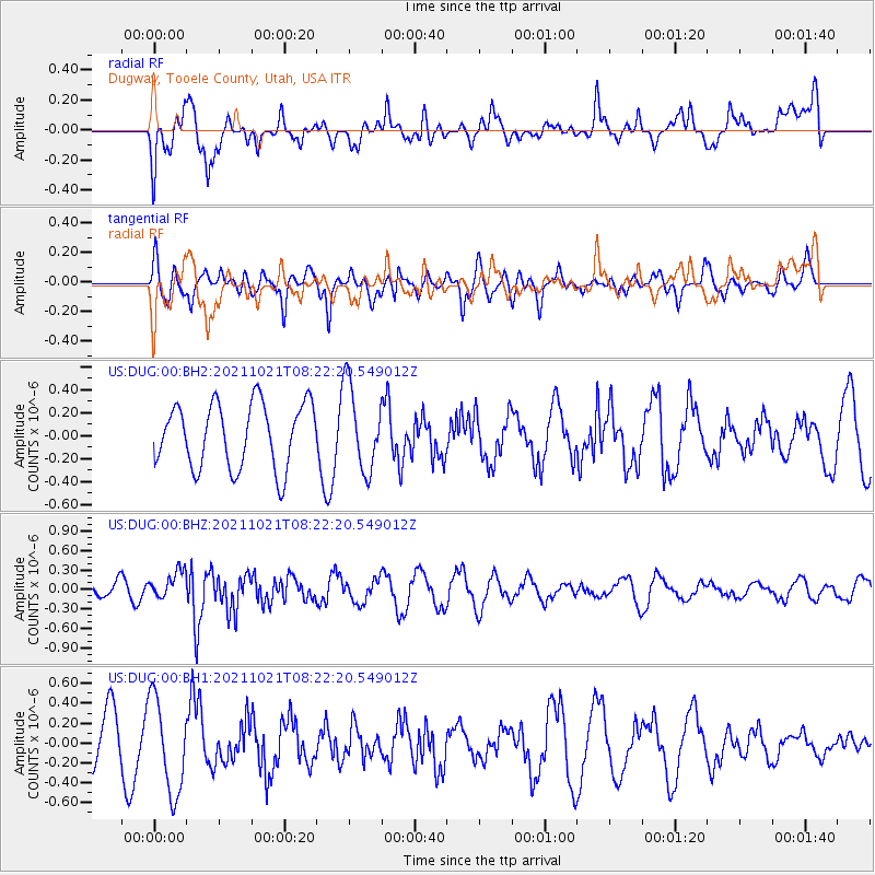
DUG Dugway, Tooele County, Utah, USA - Earthquake Result Viewer
*The percent match for this event was below the threshold and hence no stack was calculated.
| Earthquake location: |
South Of Fiji Islands |
| Earthquake latitude/longitude: |
-25.2/179.6 |
| Earthquake time(UTC): |
2021/10/21 (294) 08:10:43 GMT |
| Earthquake Depth: |
497 km |
| Earthquake Magnitude: |
6.0 mww |
| Earthquake Catalog/Contributor: |
NEIC PDE/us |
|
| Network: |
US United States National Seismic Network |
| Station: |
DUG Dugway, Tooele County, Utah, USA |
| Lat/Lon: |
40.19 N/112.81 W |
| Elevation: |
1477 m |
|
| Distance: |
90.4 deg |
| Az: |
45.066 deg |
| Baz: |
236.822 deg |
| Ray Param: |
$rayparam |
*The percent match for this event was below the threshold and hence was not used in the summary stack. |
|
| Radial Match: |
45.73456 % |
| Radial Bump: |
400 |
| Transverse Match: |
68.9336 % |
| Transverse Bump: |
400 |
| SOD ConfigId: |
26497111 |
| Insert Time: |
2021-11-04 08:22:32.903 +0000 |
| GWidth: |
2.5 |
| Max Bumps: |
400 |
| Tol: |
0.001 |
|
Signal To Noise
| Channel | StoN | STA | LTA |
| US:DUG:00:BHZ:20211021T08:22:20.549012Z | 1.5175908 | 2.1715626E-7 | 1.4309276E-7 |
| US:DUG:00:BH1:20211021T08:22:20.549012Z | 2.5498264 | 4.7352998E-7 | 1.8571068E-7 |
| US:DUG:00:BH2:20211021T08:22:20.549012Z | 1.3090911 | 3.671168E-7 | 2.804364E-7 |
| Arrivals |
| Ps | |
| PpPs | |
| PsPs/PpSs | |


