You are here: Home > Network List > IU - Global Seismograph Network (GSN - IRIS/USGS) Stations List
> Station MAKZ Makanchi, Kazakhstan > Earthquake Result Viewer
MAKZ Makanchi, Kazakhstan - Earthquake Result Viewer
*The percent match for this event was below the threshold and hence no stack was calculated.
| Earthquake location: |
Southeast Of Honshu, Japan |
| Earthquake latitude/longitude: |
32.1/138.2 |
| Earthquake time(UTC): |
2021/10/21 (294) 08:36:47 GMT |
| Earthquake Depth: |
337 km |
| Earthquake Magnitude: |
5.5 Mww |
| Earthquake Catalog/Contributor: |
NEIC PDE/us |
|
| Network: |
IU Global Seismograph Network (GSN - IRIS/USGS) |
| Station: |
MAKZ Makanchi, Kazakhstan |
| Lat/Lon: |
46.81 N/81.98 E |
| Elevation: |
600 m |
|
| Distance: |
44.9 deg |
| Az: |
306.002 deg |
| Baz: |
88.327 deg |
| Ray Param: |
$rayparam |
*The percent match for this event was below the threshold and hence was not used in the summary stack. |
|
| Radial Match: |
76.594345 % |
| Radial Bump: |
400 |
| Transverse Match: |
67.41358 % |
| Transverse Bump: |
400 |
| SOD ConfigId: |
26497111 |
| Insert Time: |
2021-11-04 08:47:35.748 +0000 |
| GWidth: |
2.5 |
| Max Bumps: |
400 |
| Tol: |
0.001 |
|
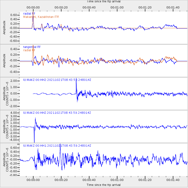
Signal To Noise
| Channel | StoN | STA | LTA |
| IU:MAKZ:00:HHZ:20211021T08:43:59.248014Z | 13.119205 | 1.107242E-6 | 8.4398565E-8 |
| IU:MAKZ:00:HH1:20211021T08:43:59.248014Z | 3.5809474 | 2.2621302E-7 | 6.317128E-8 |
| IU:MAKZ:00:HH2:20211021T08:43:59.248014Z | 7.5676374 | 5.701805E-7 | 7.534458E-8 |
| Arrivals |
| Ps | |
| PpPs | |
| PsPs/PpSs | |


