You are here: Home > Network List > UW - Pacific Northwest Regional Seismic Network Stations List
> Station HOOD Mt Hood Meadows, OR CREST BB SMO > Earthquake Result Viewer
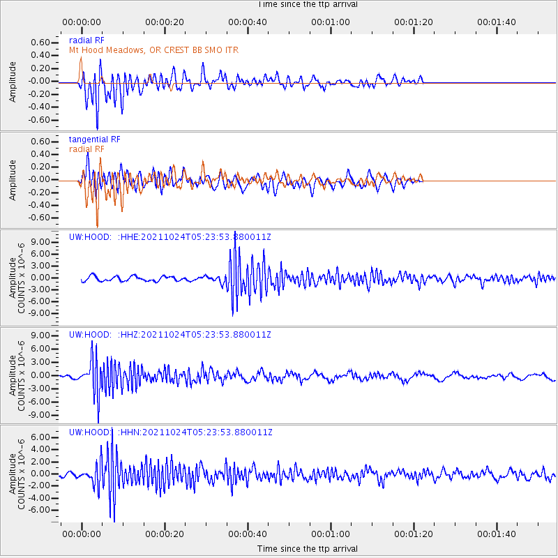
HOOD Mt Hood Meadows, OR CREST BB SMO - Earthquake Result Viewer
*The percent match for this event was below the threshold and hence no stack was calculated.
| Earthquake location: |
Taiwan |
| Earthquake latitude/longitude: |
24.6/121.8 |
| Earthquake time(UTC): |
2021/10/24 (297) 05:11:34 GMT |
| Earthquake Depth: |
65 km |
| Earthquake Magnitude: |
6.2 mww |
| Earthquake Catalog/Contributor: |
NEIC PDE/us |
|
| Network: |
UW Pacific Northwest Regional Seismic Network |
| Station: |
HOOD Mt Hood Meadows, OR CREST BB SMO |
| Lat/Lon: |
45.32 N/121.65 W |
| Elevation: |
1520 m |
|
| Distance: |
89.6 deg |
| Az: |
39.147 deg |
| Baz: |
305.439 deg |
| Ray Param: |
$rayparam |
*The percent match for this event was below the threshold and hence was not used in the summary stack. |
|
| Radial Match: |
71.86168 % |
| Radial Bump: |
400 |
| Transverse Match: |
72.77154 % |
| Transverse Bump: |
400 |
| SOD ConfigId: |
26497111 |
| Insert Time: |
2021-11-07 05:41:06.094 +0000 |
| GWidth: |
2.5 |
| Max Bumps: |
400 |
| Tol: |
0.001 |
|
Signal To Noise
| Channel | StoN | STA | LTA |
| UW:HOOD: :HHZ:20211024T05:23:53.880011Z | 13.399726 | 3.7682405E-6 | 2.8121775E-7 |
| UW:HOOD: :HHN:20211024T05:23:53.880011Z | 4.5038347 | 1.6111454E-6 | 3.5772746E-7 |
| UW:HOOD: :HHE:20211024T05:23:53.880011Z | 1.4182292 | 8.4438125E-7 | 5.953771E-7 |
| Arrivals |
| Ps | |
| PpPs | |
| PsPs/PpSs | |


