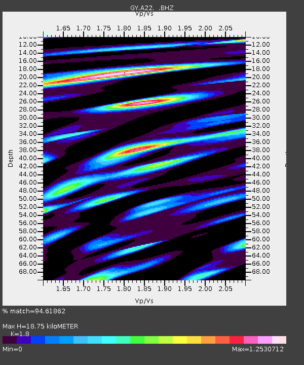
A22 GY.A22 - Earthquake Result Viewer

Earthquake location: Northern Sumatra, Indonesia
Earthquake latitude/longitude: 2.9/96.2
Earthquake time(UTC): 1993/09/01 (244) 14:03:18 GMT
Earthquake Depth: 33 km
Earthquake Magnitude: 5.8 MB, 6.2 MS, 6.0 UNKNOWN, 6.2 MW
Earthquake Catalog/Contributor: WHDF/NEIC
Network: GY Geyokcha, Turkmenistan Seismic Array
Station: A22 GY.A22
Lat/Lon: 37.93 N/58.11 E
Elevation: 663 m
Distance: 49.2 deg
Az: 319.942 deg
Baz: 125.631 deg
Ray Param: 0.06877485
Estimated Moho Depth: 18.75 km
Estimated Crust Vp/Vs: 1.80
Assumed Crust Vp: 6.53 km/s
Estimated Crust Vs: 3.628 km/s
Estimated Crust Poisson's Ratio: 0.28
Radial Match: 94.61862 %
Radial Bump: 400
Transverse Match: 94.343475 %
Transverse Bump: 400
SOD ConfigId: 4480
Insert Time: 2010-03-09 13:52:36.747 +0000
GWidth: 2.5
Max Bumps: 400
Tol: 0.001

Signal To Noise

ChannelStoNSTALTA
GY:A22: :BHZ:19930901T14:11:33.500006Z10.170141573.751456.415287
GY:A22: :BHN:19930901T14:11:33.500006Z5.724181150.5939326.30838
GY:A22: :BHE:19930901T14:11:33.500006Z6.390416253.609739.685944
Arrivals
Ps2.4 SECOND
PpPs7.6 SECOND
PsPs/PpSs10 SECOND