You are here: Home > Network List > G - GEOSCOPE Stations List
> Station KIP Kipapa, Hawai, U.S.A. (Pacific Ocean) > Earthquake Result Viewer
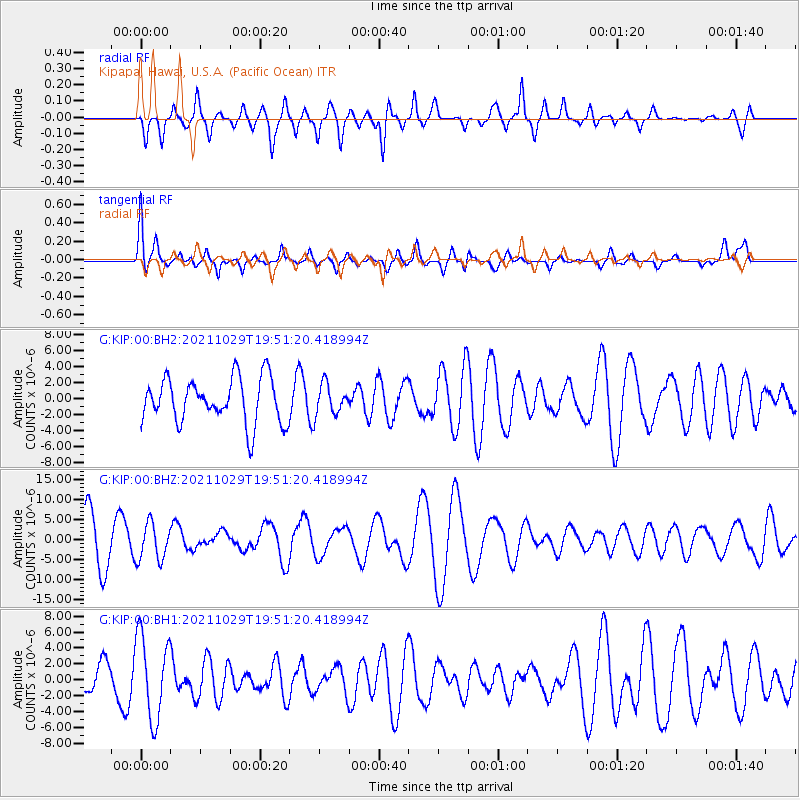
KIP Kipapa, Hawai, U.S.A. (Pacific Ocean) - Earthquake Result Viewer
*The percent match for this event was below the threshold and hence no stack was calculated.
| Earthquake location: |
Kermadec Islands Region |
| Earthquake latitude/longitude: |
-29.4/-176.1 |
| Earthquake time(UTC): |
2021/10/29 (302) 19:42:31 GMT |
| Earthquake Depth: |
10 km |
| Earthquake Magnitude: |
5.5 mww |
| Earthquake Catalog/Contributor: |
NEIC PDE/us |
|
| Network: |
G GEOSCOPE |
| Station: |
KIP Kipapa, Hawai, U.S.A. (Pacific Ocean) |
| Lat/Lon: |
21.42 N/158.01 W |
| Elevation: |
70 m |
|
| Distance: |
53.5 deg |
| Az: |
21.095 deg |
| Baz: |
199.696 deg |
| Ray Param: |
$rayparam |
*The percent match for this event was below the threshold and hence was not used in the summary stack. |
|
| Radial Match: |
58.056213 % |
| Radial Bump: |
400 |
| Transverse Match: |
58.824837 % |
| Transverse Bump: |
400 |
| SOD ConfigId: |
26497111 |
| Insert Time: |
2021-11-12 19:50:41.127 +0000 |
| GWidth: |
2.5 |
| Max Bumps: |
400 |
| Tol: |
0.001 |
|
Signal To Noise
| Channel | StoN | STA | LTA |
| G:KIP:00:BHZ:20211029T19:51:20.418994Z | 0.8277239 | 4.5655684E-6 | 5.5158102E-6 |
| G:KIP:00:BH1:20211029T19:51:20.418994Z | 2.2780674 | 5.274179E-6 | 2.3151988E-6 |
| G:KIP:00:BH2:20211029T19:51:20.418994Z | 0.6798534 | 1.9046308E-6 | 2.8015318E-6 |
| Arrivals |
| Ps | |
| PpPs | |
| PsPs/PpSs | |


