You are here: Home > Network List > AZ - ANZA Regional Network Stations List
> Station FRD AZ.FRD > Earthquake Result Viewer
FRD AZ.FRD - Earthquake Result Viewer
*The percent match for this event was below the threshold and hence no stack was calculated.
| Earthquake location: |
Near Coast Of Peru |
| Earthquake latitude/longitude: |
-15.1/-74.0 |
| Earthquake time(UTC): |
2021/10/29 (302) 19:55:26 GMT |
| Earthquake Depth: |
73 km |
| Earthquake Magnitude: |
5.2 Mww |
| Earthquake Catalog/Contributor: |
NEIC PDE/us |
|
| Network: |
AZ ANZA Regional Network |
| Station: |
FRD AZ.FRD |
| Lat/Lon: |
33.49 N/116.60 W |
| Elevation: |
1164 m |
|
| Distance: |
63.1 deg |
| Az: |
320.645 deg |
| Baz: |
132.858 deg |
| Ray Param: |
$rayparam |
*The percent match for this event was below the threshold and hence was not used in the summary stack. |
|
| Radial Match: |
63.263184 % |
| Radial Bump: |
400 |
| Transverse Match: |
80.58356 % |
| Transverse Bump: |
400 |
| SOD ConfigId: |
26497111 |
| Insert Time: |
2021-11-12 20:00:27.483 +0000 |
| GWidth: |
2.5 |
| Max Bumps: |
400 |
| Tol: |
0.001 |
|
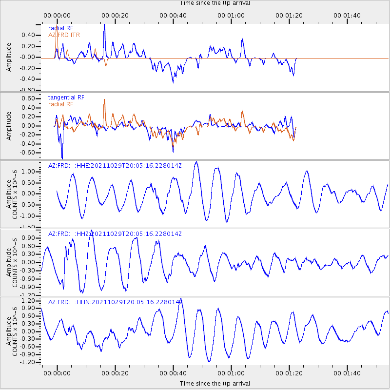
Signal To Noise
| Channel | StoN | STA | LTA |
| AZ:FRD: :HHZ:20211029T20:05:16.228014Z | 0.909277 | 5.698926E-7 | 6.2675355E-7 |
| AZ:FRD: :HHN:20211029T20:05:16.228014Z | 0.42779478 | 1.9399204E-7 | 4.5346985E-7 |
| AZ:FRD: :HHE:20211029T20:05:16.228014Z | 0.64223224 | 3.2667756E-7 | 5.086596E-7 |
| Arrivals |
| Ps | |
| PpPs | |
| PsPs/PpSs | |


