You are here: Home > Network List > G - GEOSCOPE Stations List
> Station IVI Ivittuut, Greenland > Earthquake Result Viewer
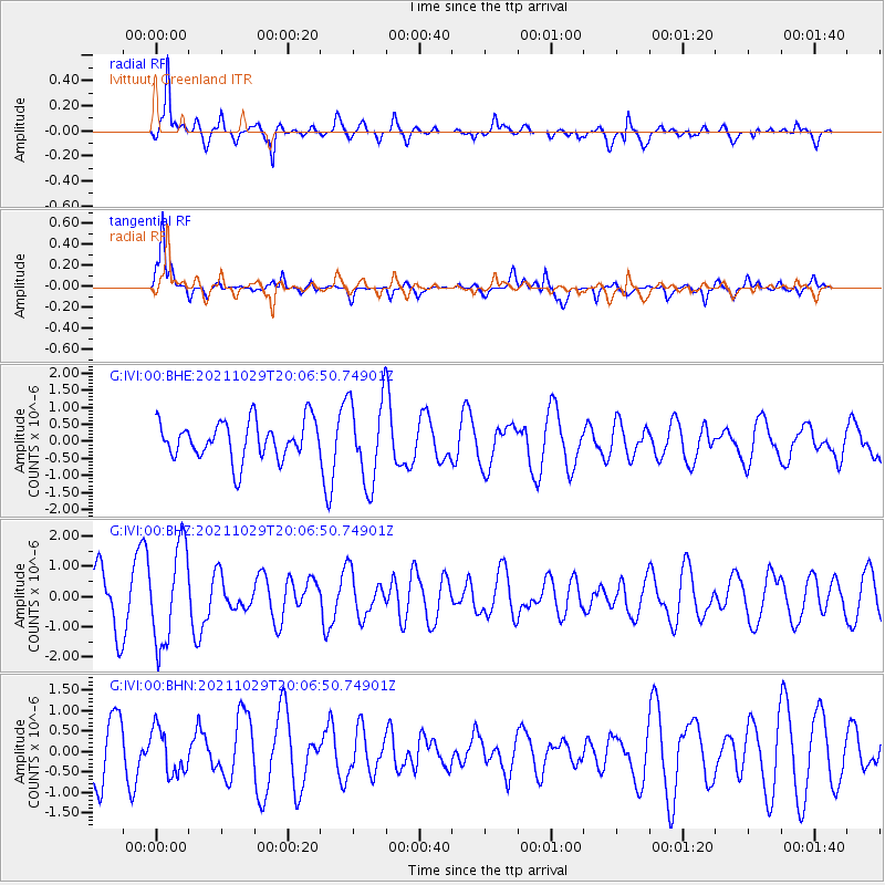
IVI Ivittuut, Greenland - Earthquake Result Viewer
*The percent match for this event was below the threshold and hence no stack was calculated.
| Earthquake location: |
Near Coast Of Peru |
| Earthquake latitude/longitude: |
-15.1/-74.0 |
| Earthquake time(UTC): |
2021/10/29 (302) 19:55:26 GMT |
| Earthquake Depth: |
73 km |
| Earthquake Magnitude: |
5.2 Mww |
| Earthquake Catalog/Contributor: |
NEIC PDE/us |
|
| Network: |
G GEOSCOPE |
| Station: |
IVI Ivittuut, Greenland |
| Lat/Lon: |
61.21 N/48.17 W |
| Elevation: |
15 m |
|
| Distance: |
78.8 deg |
| Az: |
12.421 deg |
| Baz: |
205.414 deg |
| Ray Param: |
$rayparam |
*The percent match for this event was below the threshold and hence was not used in the summary stack. |
|
| Radial Match: |
69.27387 % |
| Radial Bump: |
377 |
| Transverse Match: |
75.84638 % |
| Transverse Bump: |
368 |
| SOD ConfigId: |
26497111 |
| Insert Time: |
2021-11-12 20:04:52.649 +0000 |
| GWidth: |
2.5 |
| Max Bumps: |
400 |
| Tol: |
0.001 |
|
Signal To Noise
| Channel | StoN | STA | LTA |
| G:IVI:00:BHZ:20211029T20:06:50.74901Z | 2.1764848 | 1.6088402E-6 | 7.3919205E-7 |
| G:IVI:00:BHN:20211029T20:06:50.74901Z | 0.8489642 | 5.4909714E-7 | 6.4678477E-7 |
| G:IVI:00:BHE:20211029T20:06:50.74901Z | 2.2247589 | 1.2348148E-6 | 5.550331E-7 |
| Arrivals |
| Ps | |
| PpPs | |
| PsPs/PpSs | |


