You are here: Home > Network List > G - GEOSCOPE Stations List
> Station TAM Tamanrasset, Algeria > Earthquake Result Viewer
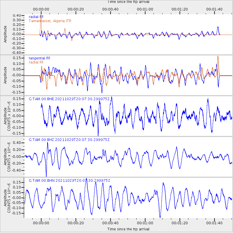
TAM Tamanrasset, Algeria - Earthquake Result Viewer
*The percent match for this event was below the threshold and hence no stack was calculated.
| Earthquake location: |
Near Coast Of Peru |
| Earthquake latitude/longitude: |
-15.1/-74.0 |
| Earthquake time(UTC): |
2021/10/29 (302) 19:55:26 GMT |
| Earthquake Depth: |
73 km |
| Earthquake Magnitude: |
5.2 Mww |
| Earthquake Catalog/Contributor: |
NEIC PDE/us |
|
| Network: |
G GEOSCOPE |
| Station: |
TAM Tamanrasset, Algeria |
| Lat/Lon: |
22.79 N/5.53 E |
| Elevation: |
1377 m |
|
| Distance: |
86.4 deg |
| Az: |
65.403 deg |
| Baz: |
252.132 deg |
| Ray Param: |
$rayparam |
*The percent match for this event was below the threshold and hence was not used in the summary stack. |
|
| Radial Match: |
49.95593 % |
| Radial Bump: |
400 |
| Transverse Match: |
47.511417 % |
| Transverse Bump: |
400 |
| SOD ConfigId: |
26497111 |
| Insert Time: |
2021-11-12 20:04:55.224 +0000 |
| GWidth: |
2.5 |
| Max Bumps: |
400 |
| Tol: |
0.001 |
|
Signal To Noise
| Channel | StoN | STA | LTA |
| G:TAM:00:BHZ:20211029T20:07:30.299975Z | 2.724303 | 2.1454154E-7 | 7.8750986E-8 |
| G:TAM:00:BHN:20211029T20:07:30.299975Z | 1.0699593 | 7.007251E-8 | 6.5490816E-8 |
| G:TAM:00:BHE:20211029T20:07:30.299975Z | 1.467423 | 7.158829E-8 | 4.878504E-8 |
| Arrivals |
| Ps | |
| PpPs | |
| PsPs/PpSs | |


