You are here: Home > Network List > US - United States National Seismic Network Stations List
> Station LKWY Lake (Yellowstone--Lake), Wyoming, USA > Earthquake Result Viewer
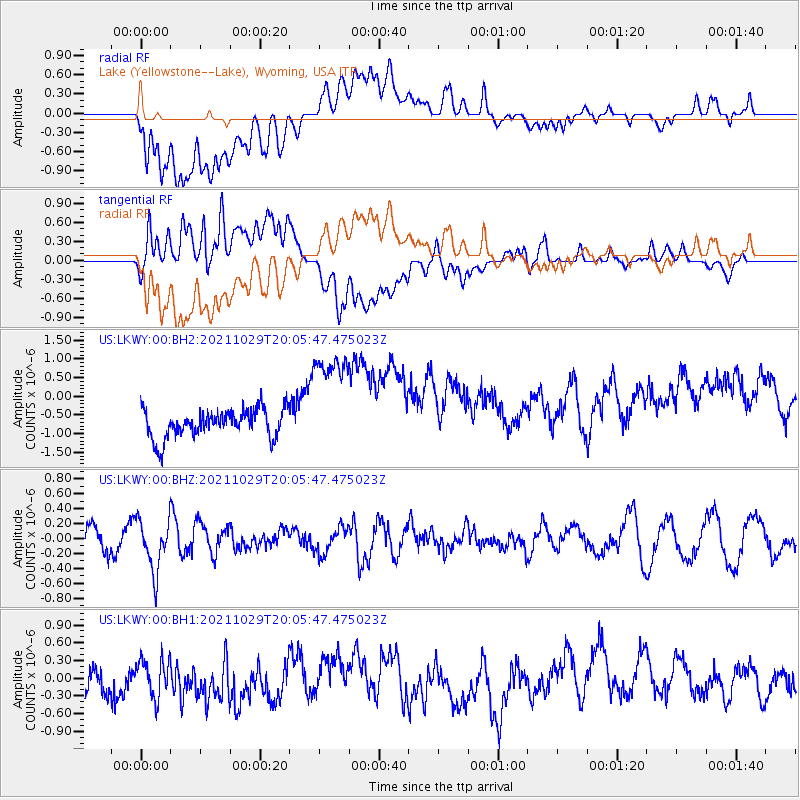
LKWY Lake (Yellowstone--Lake), Wyoming, USA - Earthquake Result Viewer
*The percent match for this event was below the threshold and hence no stack was calculated.
| Earthquake location: |
Near Coast Of Peru |
| Earthquake latitude/longitude: |
-15.1/-74.0 |
| Earthquake time(UTC): |
2021/10/29 (302) 19:55:26 GMT |
| Earthquake Depth: |
73 km |
| Earthquake Magnitude: |
5.2 Mww |
| Earthquake Catalog/Contributor: |
NEIC PDE/us |
|
| Network: |
US United States National Seismic Network |
| Station: |
LKWY Lake (Yellowstone--Lake), Wyoming, USA |
| Lat/Lon: |
44.57 N/110.40 W |
| Elevation: |
2424 m |
|
| Distance: |
68.0 deg |
| Az: |
332.774 deg |
| Baz: |
141.81 deg |
| Ray Param: |
$rayparam |
*The percent match for this event was below the threshold and hence was not used in the summary stack. |
|
| Radial Match: |
52.20585 % |
| Radial Bump: |
400 |
| Transverse Match: |
57.634308 % |
| Transverse Bump: |
400 |
| SOD ConfigId: |
26497111 |
| Insert Time: |
2021-11-12 20:13:00.146 +0000 |
| GWidth: |
2.5 |
| Max Bumps: |
400 |
| Tol: |
0.001 |
|
Signal To Noise
| Channel | StoN | STA | LTA |
| US:LKWY:00:BHZ:20211029T20:05:47.475023Z | 1.4148225 | 3.394726E-7 | 2.3994005E-7 |
| US:LKWY:00:BH1:20211029T20:05:47.475023Z | 0.8716505 | 3.481706E-7 | 3.9943833E-7 |
| US:LKWY:00:BH2:20211029T20:05:47.475023Z | 4.005934 | 1.5233643E-6 | 3.80277E-7 |
| Arrivals |
| Ps | |
| PpPs | |
| PsPs/PpSs | |


